Saturday, July 2, 2011

June Storm Pictures

Right now, it feels like the St. Louis summer has been one of these three on any given day:

1. Oppressively hot

2. Actually pretty nice

3. Stormy


Most of our storms have been either airmass (quick little pop ups) or linear systems that go by really quickly. However, we have had a few that decided to stick around for a bit, and on those storms, I was able to get some pretty nice pictures and video. These all happened at the end of the month. I hope you enjoy these!


Let's start off with Tuesday, June 21. Nothing too bad, just some really photogenic storms. There was a pretty nice lightning show with these storms, but it was mostly cloud to cloud. These storms came rolling in just at sunset, so I wasn't able to get the sharpest image. Still, I had to go for these shots!


Oh Mamma! Mammatus clouds to the south.


Same storm, just zoomed out a bit.


Next up is Saturday, June 25. A long line of storms set up across the area. There were some reports of high wind and 1" hail, but what really made this system impressive was all the lightning.


Sooooooo close to getting the most evasive shot in the weather world. I couldn't tell you if this was the beginning or end of the shot, but I had my camera aimed at the right place, and almost at the right time.


This lightning was impressive. Here is what our neighborhood looked like when lightning wasn't flashing.


Here's a shot of what the neighborhood liked while lightning was flashing. Looks like the middle of the day, but this shot was at 11:48 pm.


And of course, what would a lightning show be without some video? This video was shot just before I started taking pictures. I was indoors while shooting this. I was waiting for the lightning to be far enough away before I even thought of venturing outdoors for some photography. Earlier in the evening, we heard something get struck. Shortly after this video, something else nearby sounded like it got struck. After some time, I decided it was far enough away to go outside for photography. All that being said, enjoy the video.


Well, that's all I have for you this time. Hopefully, we'll get some more storms that decide they want to cooperate with the camera. Hope you enjoyed the pictures and video!

Tuesday, April 19, 2011

April Tunderstorm Pictures

April has been a great month so far. Namely, because we have had some cool thunderstorms. To make things interesting, there are still tornado warnings around the area, but since I'm out of them, I'll post up some pics of what I saw from home.


I'll start with the "big" day so far. April 19, 2011. You know it's going to an interesting day when storm chasers swarmed St. Louis...


Towers off to the Northeast.


Same towers with different lighting, as a storm rolled in.


Turbulent clouds.


More dark clouds. Intimidating, but that is about it.


Another cool looking cloud, but that's all it is.


There was some cool cloud movement with this video clip, but I realized my camera didn't do it justice, even after I zoomed in on it. Some of you may still enjoy it, though!


Hail to the hail!


Sorry it was blurry, but I didn't have great lighting. If I used the flash, the image was just a white shape. That is a nickel and a quarter. We actually ended up with some dime sized hail, which is the largest size hail I have actually witnessed falling.


These were from a few days ago (April 15), but it was a few cool cloud and hail shots!


Nice turbulent look in the clouds.


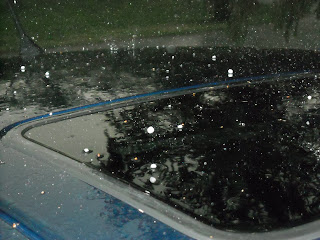
Pea sized hail bouncing off the top of my car.


I hope you enjoyed the pictures. I know I sure enjoyed taking them! As I'm posting all this, those storms (April 19) are still rolling on along, causing Tornado Warnings in southern Illinois. The storm system really looks nice, and it looks like it is finally reaching it's full strength! Here are the current SPC storm reports. They should update as the reports keep coming in.

Friday, March 11, 2011

Man vs. Machine, Day 5, Final Day

Well, this is the last forecast in this Man vs. Machine forecast contest. Day 4 was a bust, but it is just a matter of waiting until the forecast period is over to get the actual high. Unofficially, I saw a temp of 58 today, so even though I busted the temp, I'm not complaining. That being said, let's finish this contest off, and I'll try to end it on a good one. The forecast period is 7:00pm CST March 11-7:00pm CST March 12.

As always, let's start out at 500 mb. The large trough is now negatively tilted, and it is mostly impacting New England and then moving out of the United States. Behind that, we have a ridge, and the ridge will be right on top of our location before too much longer. This is typically a sign of nicer weather and warmer temperatures.

At 850 mb, things had to change at the last minute. Since the upper air soundings are taken at 7 am and 7 pm, there is a lot that can happen in the day. That is the main reason I busted temps yesterday. The 7 am map had weak cold air advection over the area, and the 7 pm map had warm air advection. That seriously impacted my temp forecast. At 850 mb now (which is off the 7 am map), the warm air advection continues. This will factor into the possibility of warmer temperatures.

The surface map is active. We have the low that impacted the area still in the United States, over New England. Then there is a low over Minnesota. This low has a cold front that may impact our area late tomorrow night or on Sunday morning. This front will more than likely pass after the forecast period is over. Finally, behind that low, there is yet another low off the Pacific Northwest. The main feature helping our weather is an area of high pressure in Louisiana. Out of all the high pressure areas on the map, this one is the highest at 1026 mb.

On the visible satellite, there were a few clouds over the area, but nothing like the past few days. At most, we were at partly cloudy today, so not too bad at all. The radar is also showing nothing, because no clouds means no precipitation. However, there is an area of clouds out in central Missouri that will probably move in ahead of the front. Looks like we'll see clouds again tomorrow.

Alright, rolling out the temperature correction chart once again for temperature forecasting. This time with warm air advection instead of cold air advection. The clouds are gone, but the winds are still pretty strong. With the nice pressure gradient over us, I don't think that is going to change at all. We've got a dew point around 30, but with warm air advection at 850 mb, I don't think the low will bottom out tonight. I'm forecasting a low of 37 degrees. Tomorrow, we should have some clouds starting to move in, so that may impact temperatures a little bit. 850 mb warm air advection should help keep the temp a bit warmer. With all this in mind, I'm forecasting tomorrow's high to be 62. I really hope this one verifies, and not just to beat the machines. It really would be nice to have temps in the 60s. With clouds moving in, we'll have partly cloudy skies, and no precipitation is expected.

Here goes nothing. Final day of contest forecasts:

Man vs. Machine Day 5 Forecasts:

Man:
Low: 37
High: 62
Weather: Partly Cloudy
Precip: 0.00"

GFS:
Low: 39
High: 58
Weather: Cloudy tonight, clear tomorrow
Precip: 0.00"

NAM:
Low: 39
High: 57
Weather: Partly Cloudy with increasing clouds
Precip: 0.00"

Well, this is it. One last wait to see which will verify. I'll put verification in the comments below. For those who stuck out reading the forecasts, thank you very much. And although I should be as neutral as possible, let's go human forecasting!

Thursday, March 10, 2011

Man vs. Machine, Day 4

So far the day 3 forecast is shaping up beautifully. Everything is almost spot on. There have been some stronger than expected winds, but that hasn't affected the forecast by that much at all. That being said, let's move on to day 4 of the contest. Once again, the forecast is for Alton, IL , with the forecast period being 7:00pm CST March 10-7:00pm CST March 11.

The 500 mb jet stream is still showing a strong trough, but it is over the Ohio Valley. Illinois is now west of the trough axis, and the ridge is on the way. Time for a little weather lesson. Once again, the actual event is more complicated. In order to get the general point across of why this is important, it will be simplified. Our location is next to a jet streak (which is a speed increase in the jet stream). We are located on the left entrance region, which is where one expects to find convergence. An area of convergence in the upper atmosphere helps push air down, while an area of divergence helps lift air up. (It all deals with vorticity or spin.) So what does this all mean for the weather forecast? Really simply, it means is air is being "pushed" down from the upper atmosphere, which helps create an area of higher surface pressure. With high pressure, you generally get nicer weather. For our area, the upper atmospheric forcing will be a big contributor in having nicer weather.

At 850 mb, there really isn't anything that should affect our area too much. There is a bit of cold air advection, which might impact temperatures, but that is about it. It's not strong, but it is there.

On the surface map, the low we just had is pushing out of the United States. Most of the continental United States is under an area of high pressure. The only other low pressure I have on my map is in British Columbia.

The last satellite images I looked at were promising for our area. The clouds were pushing out, and it looks like they will be gone within a few hours. We'll be able to see the sun tomorrow, which is a nice break from all the cloudiness as of late. Also, nothing on the radar. There was a little bit of drizzle last night around midnight, but no accumulation occurred.

With not too much to discuss, it is time to put this forecast together. No clouds tonight means we lose our "blanket" over the area. This means temps can fall tonight. I'm forecasting the low to be at 33 degrees. Tomorrow we will actually see the sun, and that means we can warm up the surface a bit. Provided the winds don't kick up too high, I will forecast my high to be at 48 degrees, through the use of a temperature correction chart. I'm not sure if we'll get a big warm up, but temps should start to rise.

Man vs. Machine Day 4 forecasts:

Man:
Low: 33
High: 48
Weather: Clear skies
Precip: 0.00"

GFS:
Low: 27
High: 51
Weather: Clear skies
Precip: 0.00"

NAM:
Low: 28
High: 53
Weather: Mostly Sunny (it calls for clear skies and partly cloudy skies, leaning more towards clear)
Precip: 0.00"

Another NWS Comparison:
Low: 28
High: 61
Weather: Sunny

Well, every forecast agrees on precip, but the high and low remains to be seen. Major gap between myself at 48 and the NWS at 61. The models are putting it right around 52. I just think the cold air advection at 850 mb will keep temps cooler. Like always, time will tell who is closer. Find out tomorrow!

Wednesday, March 9, 2011

Man vs. Machine, Day 3

Well, so far the day 2 forecast is still up for grabs. The high today was reached this morning, and the air temperature has been falling all day. It is time to start the day 3 forecast. This will cover between 7:00pm CST March 9-7:00pm CST March 10 for Alton, IL.

The 500 mb trough has pushed eastward, and as of 7:00 am CST, we were located near the trough axis (middle of the trough). Behind this trough is a ridge, which will bring nicer weather with it. Next, I took a look at the 850 mb layer. The southerly flow we had earlier this week (yes, even yesterday) has been cut off by westerly flow. The southerly flow is now farther to the east. This will cut off our major source of moisture.

The surface map has a few noticeable changes. There is a strong high pressure system north of Maine and another one located north of the Four Corners. The low pressure system that was located in Texas yesterday is now located in Indiana. The cold front actually pushed through Alton earlier today. It actually started in the morning, and pushed out by early afternoon. The next low pressure system is sitting off the Pacific Northwest.

Visible satellite imagery from earlier today showed the cloud shield still sitting over Missouri and Illinois. This will move out with the surface low. There wasn't anything on the St. Louis radar imagery. There has been a very small amount of precipitation this afternoon, but I doubt it was anything measurable. The majority of our rain in the previous forecast period occurred last night.

With very little happening weather-wise (at least for our area), this discussion will be short and sweet. The cold front that pushed through today is going to lower our temperatures for tomorrow. Unfortunately, it should be colder tomorrow than today. I'm forecasting the low to reach 37 tonight. Tomorrow, there will still be cloud cover, and I'm not sure that we'll get all that warm. Temperatures behind this front have all been in the 30s. We should be warmer than that, but not by too much. I'm forecasting tomorrow's high to be in the low 40's, with 41 being my forecast high. It should be mostly cloudy with cloud coverage breaking up throughout the day. We might see partly cloudy skies by tomorrow night. I'm not expecting any precipitation for tomorrow.

Man vs. Machine Day 3 Forecasts:

Man:
Low: 37
High: 41
Weather: Mostly Cloudy, with clouds breaking up throughout the day
Precip: 0.00"

GFS:
Low: 34
High: 45
Weather: Overcast skies, with a 30% chance of precip
Precip: 0.00"
NAM:
Low: 33
High: 44
Weather: Overcast skies, with a 43% chance of precip
Precip: .01-.09" of rain

Once again, time will tell how this chapter in the contest turns out. Tomorrow's forecast discussion will probably come out later than usual (probably the same time as today). I've got to go to class, and then I'll have to analyze the maps, so I may not get the discussion out as quickly. It should be up before 7:00pm CST. That's all for now. Thanks for reading!

Tuesday, March 8, 2011

Man vs. Machine, Day 2

So far, yesterday's forecast is looking pretty good. I find it odd, that when I last did the forecast contest, it was raining. I do it this time, and it rains again. Anyway, I'll give the verification information shortly after 7:00pm CST, after the data is reported. I may have to do a site close to Alton for precipitation verification, though. Alton/St. Louis Regional Airport is not reporting any precipitation, and I know for a fact it has been raining since before noon. It has mostly been light rain, but still there should be some measurable amount by now. All that aside, it is time for the next forecast. This forecast period is between 7:00 pm CST March 8-7:00 PM CST March 9.

What a difference a day can make in the jet stream. Yesterday there weren't any real noticeable troughs or ridges at 500 mb, just shortwave troughs. Today's 500 mb analysis provides a completely different story. There is a fairly large trough sitting across the central United States. The data from 7:00 am CST, places the edge of the trough near the Kansas/Missouri border. Behind the trough is a ridge over California.

The 850 mb map still shows strong southerly flow off the Gulf of Mexico. This will continue to provide a nice moisture inflow for the forecast area. There is also warm air advection at the 850 mb level. All this combined with the current cloud cover should help keep the nighttime low at or above last night's low. (Which was 40). This will probably aid in keeping rain around tomorrow, although it should mostly be light rain, probably nothing heavier than showers.

As for the surface map, there still isn't too much happening. The low from yesterday actually moved slightly through Texas. At the synoptic scale view, it appears to have a stationary front, a dryline, and a cold front. However, once I examined this system at the mesoscale level, I still felt it was necessary to place a warm front across Arkansas into Tennessee, rather than a stationary front. This front is giving some forcing to the system, which means it is helping to maintain the rain.

Visible satellite is showing what looks like convective towers out in western Missouri into Kansas. Radar imagery out of the Kansas City NWS also shows storms. However, they are pushing north, and should not affect our area at all. Other than that, there is just a large cloud shield on satellite, and radar imagery out of the St. Louis NWS shows a large area of precipitation with some areas being slightly stronger than others. A look at the national view of the visible satellite imagery shows the large cloud shield over the central United States. Based on this loop, I feel confident in saying that there will still be cloud cover tomorrow, but it may push out late Wednesday night into the morning on Thursday.

Now it is time to put it all together. I put a large amount of values into a temperature correction table, which helps me forecast temperatures based on current and predicted weather conditions. This takes into account many factors, such as cloud cover, precip, wind, and more. These values either add or subtract a value to the temperature, and it is a pretty accurate way to forecast temperature. That being said, after working the numbers on the chart and factoring in the dew point, I am forecasting tonight's low to be at 39 degrees, and I am forecasting tomorrow's high to be at 51 degrees. It looks like we will still have showers and light rain, but I think we should have a relatively low amount, probably somewhere between .15-.25" of rain.

The Wednesday Forecasts:

Man:
Low: 39
High: 51
Weather: Showers and light rain
Precip: .15-.25" of rain

GFS:
Low: 45
High: 50
Weather: 100% chance of precip
Precip: .5-.99" of rain

NAM:
Low: 43
High: 45
Weather: 90% chance of precip
Precip: .25-.49" of rain


Time will tell as the forecast contest keeps on going. Forecast verification will be placed in the comments section of this post. Just like yesterday, I hand analyzed my own maps, using the same site for the raw data. I might post them after the contest, just because it takes a while to do them indiviually. That's all for now. At least, until the next forecast!

Monday, March 7, 2011

Man vs. Machine Week, Day 1

It's time to start the Man vs. Machine weather forecast challenge for this week. This is the first day of the forecast challenge. Just some quick reminders, the forecast is for Alton, IL. Also, I am not allowed to use models or model produced data. After I make my forecast, the model forecasts will be displayed, with numerical values coming from the model's MOS (Model Output Statistics) data. The competition is between:
1. The GFS (The Global Forecast System)
2. The NAM (The North American Mesoscale [model])
3. Me

Alright, here it goes. Starting off at the 500 mb jet stream, there isn't too much going on. There aren't any real big troughs or ridges, but there are a few shortwaves troughs over Kansas and Colorado. These will probably help kick up some weather sometime tomorrow afternoon, as they approach the area. The next layer I want to look at is the 850 mb layer. What I find of importance here is the southerly flow off the Gulf of Mexico. It is strong over eastern Texas and across Louisiana, but as it hits the Ozarks, the winds take a turn to the east. That should provide some moisture tonight and tomorrow. Combined with the 500 mb shortwave troughs, that could provide chances of rain tomorrow. The shortwaves help with forcing or lift, and 850 flow gives moisture, so moisture and lift should be present tomorrow.

The next area I want to look at is the surface map. Really not too happening on the surface map either. There is a system in New England, but it is moving out of the US. Then there is a strong high pressure located around James Bay in eastern Ontario. There is a low located over the Rocky Mountains, but the low I am most interested in is located just south of the Oklahoma panhandle. With this low, I noticed what seems to be a weak warm front. There is a slight wind change, and a slight temperature gradient. It's nothing that jumps off the map, but I feel this was strong enough to place a front there. The only other noticeable feature with this system is the dryline down western Texas back into Mexico.

The visible satellite imagery shows a fairly large area of cloud cover over the central United States. There is a little bit of a break over eastern Missouri, which means Alton may get a little bit of sunshine later on today. The next area of cloud break is back in central Kansas. The radar shows very little going on. It looks mostly like a few light showers over central Missouri, and maybe some really light showers in central Illinois.

Now is when everything starts to roll all together. We've got moisture coming in from the Gulf of Mexico. There are some shortwave troughs at 500 mb, which should help with forcing. The low in Texas should push northeasterly, which would put Alton north of the warm front tomorrow. I don't really see the cloud cover breaking up anytime soon. I would say there is a chance of rain and thunderstorms tomorrow afternoon. There isn't strong moisture here, but it should be enough for showers with some storms, so I'll put my rain amount around .5 inch. (Give or take .05 inches).

Now the real challenge, the temperatures. For the high, I am going to look at the surface map for some guidance. The temps are mostly in the upper 40s north of that warm front. With the cloud cover, you're not going to get the sun to warm up the surface like it would on a clear day. The current temp in Alton is 41. It is mostly cloudy with a bit of sun breaking through. The clouds overnight will help maintain a warmer temp. Tomorrow's high should be in the upper 40s. I'll go with a high of 49. As for tonight's low, it can't fall below the dew point, so that helps establish a lower limit. The current dew point is 34. With some moisture advecting in, that should raise the dew point a little. With current dew points south of here not being too much higher, I'll put tonight's low at 37. Since the new day in Zulu time is at 7 pm, that is when I will grab the data for verification. The next forecast period will start at 7pm CST March 8 and go to 7pm CST March 9.

So Man forecast:
Tonight's low: 37
Tomorrow's high: 49
Conditions: Showers and thunderstorms
Precip: around .5 inch (+/- .05")

GFS:
Low: 34
High: 57
Weather: 70% chance of rain
Precip: .1-.25" of rain

NAM:
Low: 35
High: 55
Weather: 80% chance of rain
Precip: .1-.25" of rain

And just for comparing the NWS in St. Louis Point forecast:
Low: 36
High: 55
Weather: 60% showers with 90% storms Tuesday night
Precip: Not listed.

By the way, I linked up the maps I normally do after the discussion, if you want to see what type of data I used here are the links. [Surface US and Local ] [500 mb] [850 mb]I made a mistake of trying to analyze the maps in Microsoft Paint, which works, but makes them harder to read. Tyring to save on some paper. I'll post the forecast verification in the comments section after the forecast period is over, and I'll have a new discussion up tomorrow.

Sunday, March 6, 2011

Man vs. Machine, Round 2

Some of you may remember that 2 years ago, I did a man vs. machine forecast, where I made a forecast without any model data, and then put the model forecasts up to see who would be closer. I've been interested in doing that again, so I'll be doing it again this week. The only big change, this time the contest will last Monday through Friday (meaning a forecast everyday this week). The forecast site is Alton, IL. Why? I am here, and I can make physical observations if needed.

Just like last time, the only data I will have access to is surface data, upper air data, radar, satellite, and the Skew-T ln-P chart. With the Skew-T, most of them have computed values on the chart. I will be ignoring those, and focusing only on the chart itself. If I want to look at values from the chart, I must calculate them myself. After I write my forecast, I will then look at the model data to put up their forecast, but just to put up their forecast. For numerical values (such as temps) I will use the model's MOS guidance for KALN.

For those who didn't see this contest last time, here's why I do it. A couple of years ago, I was in a rush to finish a forecast, and I pulled model data to finish, even though I didn't agree with it. It was calling for overcast skies, and I didn't think it would happen. I figured I was a young forecaster and the model is a supercomputer cranking out equations, it is probably right. Next day, not a cloud in the sky. After that bust, I said I would only ever use models for forecast guidance, but never again would I trust the model without looking at everything. So, I did the man vs. machine, and I think I won, since all my numbers were closer to the actual results than the computers.

I figure it is time to do this again, and this time the challenge is increased. Instead of just one day, this will be a week. I'm looking forward to this, and I hope you are too. This is going to be fun!

Surprising End to February

What a weird way to end the month. Here in Alton, temps would swing from cold one week to warm the next. To give an idea, we had one week in the 50s and 60s, and the next week was back in the 40s. Then to make the end of the month even more interesting, let's throw in a bunch of tornadoes as well. Yes, you read that right, tornadoes.

February 27 was an interesting day. To start, the high was in the 60s, not your typical February weather. Add on the fact that the Storm Prediction Center convective outlooks had a moderate outlook just south of Alton. Here is the outlook for Feb. 27. This is later in the day, close to when the storms were starting up.

Although the chance for tornadoes was about 5% for Alton, the chance ramped up to 10% just south of the area. All the weather conditions were pointing to the storm going linear, which it did. With this type of system, straight line winds are generally the primary severe weather threat. Based on everything I had seen that day, I was even thinking "Oh, this will mostly be a straight line wind event here [Here being Alton]." The storm rolls in, it goes linear, and it drops tornadoes to the south here. Here is a radar loop of the storm. You'll have to click a few things to get this to run. For the date [Feb. 28, 2011], then click "Go!". (This storm took place after 7 pm CST, so it rolls to the next day in Zulu time). After you've done that, click on "Radar Composites" then "Radar Composites cent missvly", and you should be looking at the radar of this storm.

The SPC reports came in as straight line winds. [Reports Feb. 27 and Feb. 28] After damage surveys by the National Weather Service in St. Louis, MO, there have been confirmed tornadoes. Here is their damage survey data, with a nice map of the area. If you click on the blue dots on the map, you can pull up information on that event. If you want to make this event even more odd, just look at this report from the NWS St. Louis just a few days earlier. Like I said earlier, this was a really weird end to February.

Thursday, January 20, 2011

Snowfall Update

The last system that moved through left some rather heavy snowfall totals. Areas in St. Louis recieved upwards of 1 foot of snow. It wasn't nearly as bad here in Alton. I measured the snow depth soon after it stopped snowing, and the amount came to 7.6 inches of snow. The snow started around 8:00 pm last night, and ended around 2:00 pm today. Pretty impresive snow fall totals for such a short period of time. The National Weather Service in St. Louis has a nice graphic showing the total. Here is the link to it. You'll have to scroll over the map to expand it, but it is a really good map for this event.

Friday, December 31, 2010

Last Post of 2010

Hey all,

This being New Year's Eve, this will be the last post of 2010. I originally planned on writing a forecast for tomorrow, but my plans were changed this morning. I got online to look at weather, seeing that most of the St. Louis area was under a tornado watch. Within minutes, there were tornado warnings posted. I jumped into "Severe Weather Mode" which kept me glued to radar and the skies. After the reports are completed, I'll put them up here for you to see. The severe weather mostly stayed south of Alton, so no cool pictures from me this time.

On a slightly different topic, with the new year coming, I am wondering if there are anythings you would like to see on the blog in 2011. I've been leaving forecast verifications in the comments section starting this year. If there are anythings you would like to see (that are reasonable), I'll see what I can do on putting them on this blog. Also, if you are just an occasional reader, but would read more often if there was some improvements, please let me know. Anything that helps spread the word on the weather. So please, if you would like to see changes, write a comment in the comments section, and I'll see what I can do.

Well, I'm going to keep this short and sweet. Have a safe and happy new year! I'll write to you all in 2011!

Saturday, December 25, 2010

Snowfall Update

Hey all,

Here's the latest update on snowfall totals. I really cut it close on the Alton forecast. While areas in St. Louis were recording 4 inches or greater, I measured 3 inches in Alton. Just clipped my upper limit on that forecast! Other reports from around St. Louis.

I was just a bit too low on DeKalb, as the official report was 5.1 inches. Looks like the snow to liquid ratio was a bit higher than I expected, but that is weather for you. Here are the reports from around Chicago.

I hope everyone enjoyed their day! Merry Christmas!

Thursday, December 23, 2010

I'm Dreaming....

'Tis the season of giving, so today I am giving a double forecast. With Christmas being just 2 days away (really seems like the year went fast), there is always the conversation of whether or not there will be a white Christmas. There is a nice set-up out in the West, and it is heading for the Midwest. It's time to see if Alton and/or DeKalb will have a white Christmas!

Let's start by looking at the system. The jetstream has a very nice trough out west, with the trough axis in central Utah as of 1200Z (6 am CST). This trough will continue its eastward journey, and by midday tomorrow (Christmas Eve) the trough axis should be around the Oklahoma Panhandle. Current forecast models show that the trough will then track across Illinois, and moving out of Illinois Christmas morning. As this trough approaches Illinois, the lower level winds (at 850 mb), will begin to flow from the south, bringing in some moisture from the Gulf of Mexico. This will contribute in forcing precipitation from this system. After this trough passes, Illinois will be sitting under a fairly large ridge.

Normally, I would be getting ready to blame some surface feature for the possibility of precipitation. This time, it appears there will be another forcing mechanism for the snow. The low in Colorado is looking like it will take a southern turn, and come evening Christmas Eve, the low should be crossing Texas. With a ridge following in the jet stream, Illinois will mostly be seeing high pressure at the surface after this event.

Currently, the cause of possible snow, seems to be isentropic forcing. This will take a bit of explanation, and I will do the best I can to explain it. Please remember, I am trying to explain a complex process as simply as I can.

In meteorology, we have a variable known as potential temperature. This is the temperature that an unsaturated parcel of air would have if you brought the parcel adiabatically to 1000 mb pressure. Here's the big deal about it for purpose of this discussion: Parcels like to "ride along" on this temperature. The parcels basically treat this as a sort of "ski lift." I'll bring in a chart soon which should help you visualize this.

Here is the cross section of the atmosphere between Slidell, LA (left) and Green Bay, WI (right) (conveniently right through the forecast area!) The red lines are lines of potential temperature (in meteorology, commonly called "theta", since that is the variable used in calculations.) Notice, as the potential temperature lines approach Green Bay, they go up in height. Remember, parcels are riding along this line of potential temperature. As the parcels rise, their actual air temperature decreases, and brings it closer to the dew point. When the air temperature and the dewpoint temperature reach the same temperature, you have saturation. As the atmosphere reaches saturation, you begin to form clouds and can form precipitation.

Basically, isentropic forcing is when you get this type of situation, where parcels are "riding" lines of potential temperature and forcing out precipitation. There is a whole lot involved in this process, but I am really trying to give a very simple explanation for something that is not very simple. However, this appears that it will be the culprit for any snow caused on Christmas Eve and into Christmas day.

Now for the fun part, which is snowfall accumulation. So I'll start with Alton, and then I'll finish with DeKalb.

For Alton, IL, models seem to put the best time for snow to be in the afternoon into the evening on Christmas Eve, with snow falling overnight, and flurries on Christmas. MOS guidance shows probabilities of precipitation to be well over 70%, so it looks like Alton, IL will be having a white Christmas! As for amounts, based on what I am seeing, I feel confident that there will be about 1-3 inches of snow across the area, with local amounts reaching 4 inches.

For DeKalb, IL, everything seems to be pointing to similar conditions. It looks like the snow may begin around the middle of the afternoon on Christmas Eve, but these will more than likely be flurries. The snow should pick up into the evening hours, and it looks like there may be a few flurries on Christmas. MOS guidance isn't as high as Alton, but still shows around a 70% chance of precipitation on Christmas Eve. All in all, I believe DeKalb, IL will also be having a white Christmas! Based on the data, I am going with 2-4 inches of snow for DeKalb, with local amounts being up to 5 inches.

Well, that concludes this discussion. It looks like both areas will be having a white Christmas. If anyone is wondering what I'm wishing for, it would be a job (even part-time) or funding so I can go to graduate school in the fall, but that's another story, for another day. Have a safe and enjoyable holiday. Merry Christmas everyone!

Friday, November 26, 2010

All Sorts of November Craziness!

A few posts ago, I was talking about how weird this particular November has been. Well, just about a week after that post, November decided to keep up the craziness. When I think of the month of November, I'm thinking overcast skies, drizzle, and colder temperatures. This past week in the state of Illinois, that normal expectation has been thrown out the door. Illinois has had thunderstorms, tornadoes, flooding, and freezing rain all in a short time span.

If you are anything like me, the first word on that list that jumped out was "tornadoes." This was especially true for those of you in northern Illinois. I was stunned when I heard about a November tornado, but the National Weather Service in Romeoville, IL has a great article on the event, as well as a nice picture of the tornado. They also provide a nice recap of the event, so I'll pass those on for you to read. The following hyperlinks will take you to those stories:

The first article (with the picture of the tornado)

Updated version (no tornado picture, sadly)

Confirmation story (with damage photos and storm reports)

Late season tornado climatology (interesting read)

SPC Storm Reports


Now for the rest of the November mayhem. While all of that fun was occurring up north, the weather had other plans for the greater St. Louis area. There were some tornado warnings issued with a long line of thunderstorms, but no tornadoes were reported in southern Illinois (there were a few in central Missouri.) The Wednesday before Thanksgiving was a wet day, as rain fell almost all day. This rain continued into Thanksgiving day, where it later switched into a nice wintry mix of snow and sleet. Here is a link to the rain totals as collected by the St. Louis, MO National Weather Service.

In short, it has been a highly eventful November. I hope you all enjoyed these stories, and I hope you all had a Happy Thanksgiving.

Friday, November 19, 2010

Football Forecast

Here we go with a "floater forecast." This is one of the forecasts not for Alton or DeKalb, but rather somewhere else in the nation. This forecast is for Muncie, IN, where the Northern Illinois University Huskies will take on the Ball State Cardinals in football on Saturday!

First off, how about those Huskies?! NIU is 8-2 overall this season, with a perfect 6-0 record in conference (MAC) play. Only 5 other teams in the nation are undefeated in their respective conferences. NIU is also ranked 29th in the nation in both the Coaches and AP polls! They will be facing the Ball State Cardinals (4-7, 3-4 in conference (MAC)) in Muncie, IN at 11:00 AM (CST). The Huskies only need to win 1 of their last 2 games to become MAC West Champions. Since the sports stats are done, let's look at what the weather may be for this game.

Across the Midwest, the jet stream is in a ridge pattern. This should bring warmer than average temperatures as well as nice weather. Just north of this ridge, in eastern Manitoba/western Ontario, there is a small shortwave in the jet stream. This shortwave is just behind a surface low.

Speaking of the surface, the surface map is a bit active. There is a low in Ontario, with a cold front extending through Wisconsin, Iowa, northwestern Missouri, and Kansas. West of the Rocky Mountains, there are many different surface lows, in the states Idaho, Oregon, Nevada, California, and Wyoming.

The primary concern is the low in Ontario. The cold front associated with this system will move towards the southeast. At this time, it is looking like the cold front will be near Muncie, IN around 1:00 PM (EST). Since the game starts at Noon EST, this front should hit during the game. It is associated with a occluding (weakening) system, and since this system does not have a strong pressure gradient, it should not affect wind speeds too much. Additionally, the lack of moisture in the area will eliminate the possibility for rain.

Examination of both surface data and Model Output Statistics (MOS) guidance, shows that temperatures should be a bit chilly, but good football weather, with the high expected to be around 53 degrees. Temperatures should be in the upper 40s/lower 50s around kickoff, and warm up throughout the game.

10/20/10 Muncie, IN Forecast:
Overnight Low: 36
Daytime High: 53
Kickoff Temperature: 49
Winds: 5-10 MPH out of the South
Conditions: Partly Cloudy

And it wouldn't be a football forecast without a score prediction. I admit to being bias towards NIU, since I spent a great 4 years of my life there, but I will try to keep bias out of the prediction. So, here's my prediction:

NIU 42
BSU 17

Let's see how both the forecast and prediction turn out. I'll leave you with this: GO HUSKIES!

Wednesday, November 17, 2010

Alton, IL 10/18/2010 Forecast

Simply put, this has been a weird November. There is a quote for Midwest weather patterns which has been true for this month. "If you don't like the weather, wait 15 minutes, and it will be different." Okay, maybe not 15 minutes, but the weather changes over one week has been incredible. Last week, we were experiencing temperatures in the upper 60s and into the 70s in Alton. The weather was nice enough, that one could have worn shorts if they so desired. This week, the weather has people grabbing jackets before heading out the door. That being said, let's take a look at this weather!

Let's start by taking a look at the surface map. Remember, this link will provide the current surface map, so it may be different than the map at time of this discussion. There are 3 low pressure systems spread across the country right now. The first low is in Canada, just north of New York state and Vermont. The next low is the one impacting Illinois. This low is in northeastern Oklahoma/southwestern Missouri. This low will be discussed in greater depth for this discussion. The last low is sitting out in the Pacific Ocean, northwest of Oregon, and it may cause forecast issues this weekend into early next week.

The main forecast concern for Alton is the low in northeastern Oklahoma/southwestern Missouri. This low is occluding, which means the system is weakening. This low has a warm front extending into portions of southern Illinois. Being north of the warm front puts us in prime position to see some precipitation. The radar from the National Weather Service in St. Louis, MO shows a "precipitation shield" heading towards the greater St. Louis area. This is mostly light rain, and should impact the area during the early morning hours of the 18th. This is mostly light rain, although lowering temperatures overnight may cause the occasional snowflake, but no accumulation is expected.

Upper air analysis shows the area is under a trough, but forecast models project that the area will be out of the trough midday tomorrow. Then a ridge will dominate the weather pattern for the next few days, bringing warmer temperatures along with dry conditions.

Overall, not too many major weather shifts should be expected over the next few days. Basically there should be some rain overnight on the 17th into the early hours of the 18th, and then rain is out of the forecast until the weekend. In that time span, temperatures should warm up a bit, but nothing as warm as last week. It looks like fall is going to try to stick around the area for a little bit.

10/18/2010 Alton, IL Forecast:
High: 47
Overnight Low: 36
Rain Amount: Less than .10"
Conditions: Mostly cloudy, with clouds decreasing during the day

10/19/2010 Alton, IL Forecast:
High: 57
Overnight Low: 33
Rain Amount: 0"
Conditions: Clear skies

I would like to add a quick note. I have been encountering some technical issues recently, or else I would have posted sooner.

Thursday, October 28, 2010

Big Storm Wrap-Up

To say the very least, it has been windy the past few days. The recent storm was one we will not see for a while. This storm was historical to say the least. I'd like to make a quick correction before diving into this post. In the last post, I said the Edmund Fitzgerald storm reached a pressure as low as 976 mb. The lowest recorded pressure was 980 mb. The 976 mb pressure I discussed was actually from a simulation of the storm.

As for the 980 mb pressure in the Fitzgerald storm, it was blown away by the pressure in this last storm. This recent storm's lowest pressure reached 954 mb! Remember that 1013 mb is standard atmospheric pressure. The low in this storm was almost 60 mb below standard atmospheric pressure, which is extremely rare in mid-latitude cyclones. Here is a surface map from the Hydrometeorological Prediction Center of this storm at its peak intensity:


This surface map only shows the pressure at 956 mb, but just a few hours afterwards, this system hit 954 mb.
Not only did this system hit an astounding low pressure, but it also produced numerous storm reports. At one point, there were tornado warnings extending from Michigan to Alabama, while there was a blizzard in North Dakota, and it was all from the same system. Here are the Storm Prediction Center damage reports over a 3-day period where this system was producing violent weather. Blue marks are damaging wind, green is hail, and red is tornadoes.

October 25, 2010

October 26, 2010

October 27, 2010

The wind damage produced in Illinois on October 25 was mostly overnight into morning. From there, the storm continued producing damaging winds, and it even went on to producing tornadoes.

This storm has mostly moved out of the United States, with just a few remnants of the system remaining. Its pressure has risen back to around 996 mb (not nearly as intense as it was). It is always fascinating how powerful these big historic systems can become. I know I will remember the excitement and awe of watching this storm for a long time.


Monday, October 25, 2010

Dropping a Meteorological Bomb!

Hey all!

First, I apologize for my lack of any posting in months. I thought I'd have time after getting back to school to put up the post, but I then realized I couldn't find the camera cord (so no pictures then). Then classes, homework, and organizations kept my week booked, often leaving me working into the wee hours of the morning. Then bad habits started of not posting, but there's no excuse for my lack of posting now, so I will start posting more often. Again, I apologize.

The reason I had a big urge to post tonight, is because out in the plains right now sits a large low pressure. While this low was sitting out in western Nebraska, storm warnings were being issued by the National Weather Service over Lake Michigan and Lake Superior. The NWS is calling for winds over Lake Michigan to reach up to 60 knots (about 69 mph winds)! They are also predicting wave heights to be as high as 20 feet, with the occasional wave reaching 30 feet high! As of 11:15 pm (Central time), the low pressure with this system was 980 millibar (mb for short). For those not used to pressure in millibar, 1013.25 mb is a standard atmosphere. Basically, this storm is roughly 30 millibar below standard atmospheric pressure, and still intensifying! What makes this storm a bomb is the pressure drop. A meteorological "bomb" is a storm that drops 24 mb of pressure in 24 hours. That is a rapid intensification for any storm, and generally these bombs produce big weather events.

The low pressure is associated with a strong pressure gradient, and this will be the primary reason for the intense winds. Here is the last surface map from the Hydrometeorological Prediction Center. The map will update with time, so it may be different while you examine it.

For some historical reference, the storm that sunk the Edmund Fitzgerald back in 1975, was producing winds around 40-50 knots (46-58 mph)! A reading was from the then nearby ship Arthur M Anderson measured wind gusts at 75 knots (86 mph)! Wave heights with this storm were around 18-25 feet tall waves. Pressure with this storm got as low as 976 mb!

To make this system even more fun, there is a nice cold front associated with this system. This will allow thunderstorms to fire up along the front. The Storm Prediction Center has already been issuing outlooks for severe weather potential over land. A moderate threat for severe weather has been issued by the SPC for Tuesday, October 26, 2010. The primary threat with this system will be damaging winds across most of Illinois. Basically, with the SPC issuing a 45% chance of damaging winds, there is a very good chance of seeing them (scroll over the "wind" portion of the banner to see the percentages). If you noticed the hatch marks on the map, that may require an explanation. Since this is primarily a wind threat, I'll explain with wind. If you are in an unhatched area (and have a probability above your location), you have that percent chance (say 25%, for example) of seeing 50 knot wind damage 25 miles from any point in that location. If it is hatched, then expect that percent (in this case 45%) chance of seeing 65 knot wind damage 25 miles from any point in the hatched area. Since most of the state of Illinois is under a hatched region, there will more than likely be a lot of wind damage reports across the state.

So basically, try not to get blown away (literally), but be ready to be "blown away" (figuratively) by the awesome spectacle we are about to witness. We probably won't see a storm this strong for a while.

Sunday, January 17, 2010

Big Post Soon

Hey all!

I am currently in Atlanta, Georgia at the National American Meteorological Society Meeting. I got selected as a student volunteer, so it is almost like getting paid a bit to go to the conference! Anyhow, I have some pictures (but no camera cable) and some stories to tell, but I am goint to post them after the meeting (and upload the pictures).

-Chuck

Sunday, December 6, 2009

First Winter Storm of the Season?

This one is really shaping up nice, should be interesting. What is really neat, is the Quad Cities NWS office was going with a chance of a blizzard 5 days out. Depending on the wind speeds that might just verify...


FORECAST FOR DEKALB AND VICINITY, 12/6/09, 11:00 AM

Today...mostly cloudy. High of 34 degrees. South winds at 5-10 MPH.

Tonight...chance of light snow. Low of 26 degrees. South winds around 5 MPH.

Tomorrow...chance of snow. High of 33 degrees. North winds at 5-10 MPH.

Extended outlook...Tuesday through Saturday...

Tuesday...chance of snow showers, with chance increasing Tuesday night. Low in the middle 20s. High in the lower 30s.

Wednesday...snow likely, with increased wind. Low in the middle to upper 20s. High in the upper 20s.

Thursday...partly cloudy. Low in the lower teens. High around 20.

Friday...partly cloudy. Low in the middle teens. High in the middle 20s.

Saturday...chance of snow showers. Low in the middle to upper teens. High in the middle 20s.

*********************************************
CLIMATE DATA: Yesterday's high, 33 degrees; last night's low, 20 degrees. The average high/low temperature is 37/22. We had no precipitation at the DeKalb campus over the last 24 hours as of 7 AM this morning.

We have had 0.01" inches of liquid equivalent this month, and .5" of snow. On average, we should see 2.18" of liquid equivalent, and 9.5" of snow by December 31. We have had 43.11" of liquid equivalent as of this point this year, and .5" of snow. On average we should have seen 37.40" of annual liquid precipitation by December 31.
*********************************************
SEVERE/HAZARDOUS WEATHER OUTLOOK: Everything is beginning to indicate a winter storm Tuesday into Wednesday. Forecast models track the storm over our area, and they are also showing increased wind speed.
*********************************************
PRECIPITATION: Tonight into Monday: chance of light snow showers. With this, about .01-.1" liquid equivalent and snow up to 1", with 40% coverage.

Tuesday into Wednesday: .5"-1" of liquid equivalent, snow between 4"-8" with 80% coverage.
*********************************************
FORECAST DISCUSSION: Everything is starting to point towards trouble come midweek. Forecast models continue to track a strengthening low over our area Tuesday through Wednesday, bringing with it some heavy snow. On top of this problem, winds speeds are forecasted to increase, to at least 20 MPH on Wednesday, causing blowing snow.

This morning's surface map has a low in Wisconsin, with a cold front tracking back across Iowa, Missouri, and Kansas. There is also a low in the panhandle of Oklahoma, with a cold front across Texas and New Mexico. Then there is our concern later this week, a low in central Colorado.

The cold front in Iowa, should pass through our area later today, and with it, we may see some light snow showers. The chance of snow comes mostly tonight and tomorrow before noon. Total accumulation with this system could be around 1".

After the snow stops tomorrow, we have a small break before we see snow again. The Colorado low should be entering our region Tuesday afternoon, with a chance of snow. Tuesday night, the chance of snow increases as the system will be much closer, and that chance stays high throughout Wednesday. We'll be looking at heavy snowfall, with possible amounts around 4"-8". We also will be having increased wind speeds, causing drifting snow. If the low tracks closer to us, we may see some mixed precipitation, including sleet and freezing rain. This is going to be a nasty system.

After the system moves out, the temperatures will drop again. Thursday and Friday should have partly cloudy skies, but highs only in the lower to middle 20s and lows in the lower to middle teens. Since the big system will have just passed, it should still be windy, so the wind chills will be even colder.

Saturday and Sunday are about the same as Thursday and Friday. There is a small chance of seeing a snow shower on Saturday, but it would not be a big one if it does snow. Sunday we actually begin to warm up again, with highs in the upper 20s.

At this point in time, the best thing to do would be stay posted to the weather. As that storm approaches, there may be changes in snowfall totals and in wind speeds. The system midweek is looking really nasty, so definitely keep an eye on it. Other than that system, prepare for a few light snow showers and cold temperatures and wind chills. After these systems, the roads may get a little nasty, so drive safely, and keep warm.

********************************************
Chuck Richie II
Northern Illinois University undergraduate meteorology student
e-mail: crichie2@gmail.com

It should be interesting to see how this one pans out. Looks like a winter storm for sure, but will it hit blizzard criteria? (35 MPH winds or greater, storm sustained for 3 hours, and less than a 1/4 mile visibility) Time will tell, so keep an eye on this one.