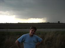
Simply put, this has been a weird November. There is a quote for Midwest weather patterns which has been true for this month. "If you don't like the weather, wait 15 minutes, and it will be different." Okay, maybe not 15 minutes, but the weather changes over one week has been incredible. Last week, we were experiencing temperatures in the upper 60s and into the 70s in Alton. The weather was nice enough, that one could have worn shorts if they so desired. This week, the weather has people grabbing jackets before heading out the door. That being said, let's take a look at this weather!
Let's start by taking a look at the surface map. Remember, this link will provide the current surface map, so it may be different than the map at time of this discussion. There are 3 low pressure systems spread across the country right now. The first low is in Canada, just north of New York state and Vermont. The next low is the one impacting Illinois. This low is in northeastern Oklahoma/southwestern Missouri. This low will be discussed in greater depth for this discussion. The last low is sitting out in the Pacific Ocean, northwest of Oregon, and it may cause forecast issues this weekend into early next week.
The main forecast concern for Alton is the low in northeastern Oklahoma/southwestern Missouri. This low is occluding, which means the system is weakening. This low has a warm front extending into portions of southern Illinois. Being north of the warm front puts us in prime position to see some precipitation. The radar from the National Weather Service in St. Louis, MO shows a "precipitation shield" heading towards the greater St. Louis area. This is mostly light rain, and should impact the area during the early morning hours of the 18th. This is mostly light rain, although lowering temperatures overnight may cause the occasional snowflake, but no accumulation is expected.
Upper air analysis shows the area is under a trough, but forecast models project that the area will be out of the trough midday tomorrow. Then a ridge will dominate the weather pattern for the next few days, bringing warmer temperatures along with dry conditions.
Overall, not too many major weather shifts should be expected over the next few days. Basically there should be some rain overnight on the 17th into the early hours of the 18th, and then rain is out of the forecast until the weekend. In that time span, temperatures should warm up a bit, but nothing as warm as last week. It looks like fall is going to try to stick around the area for a little bit.
10/18/2010 Alton, IL Forecast:
High: 47
Overnight Low: 36
Rain Amount: Less than .10"
Conditions: Mostly cloudy, with clouds decreasing during the day
10/19/2010 Alton, IL Forecast:
High: 57
Overnight Low: 33
Rain Amount: 0"
Conditions: Clear skies
I would like to add a quick note. I have been encountering some technical issues recently, or else I would have posted sooner.
Wednesday, November 17, 2010

Thursday, October 28, 2010
Big Storm Wrap-Up
To say the very least, it has been windy the past few days. The recent storm was one we will not see for a while. This storm was historical to say the least. I'd like to make a quick correction before diving into this post. In the last post, I said the Edmund Fitzgerald storm reached a pressure as low as 976 mb. The lowest recorded pressure was 980 mb. The 976 mb pressure I discussed was actually from a simulation of the storm.
As for the 980 mb pressure in the Fitzgerald storm, it was blown away by the pressure in this last storm. This recent storm's lowest pressure reached 954 mb! Remember that 1013 mb is standard atmospheric pressure. The low in this storm was almost 60 mb below standard atmospheric pressure, which is extremely rare in mid-latitude cyclones. Here is a surface map from the Hydrometeorological Prediction Center of this storm at its peak intensity:
As for the 980 mb pressure in the Fitzgerald storm, it was blown away by the pressure in this last storm. This recent storm's lowest pressure reached 954 mb! Remember that 1013 mb is standard atmospheric pressure. The low in this storm was almost 60 mb below standard atmospheric pressure, which is extremely rare in mid-latitude cyclones. Here is a surface map from the Hydrometeorological Prediction Center of this storm at its peak intensity:
 This surface map only shows the pressure at 956 mb, but just a few hours afterwards, this system hit 954 mb.
Not only did this system hit an astounding low pressure, but it also produced numerous storm reports. At one point, there were tornado warnings extending from Michigan to Alabama, while there was a blizzard in North Dakota, and it was all from the same system. Here are the Storm Prediction Center damage reports over a 3-day period where this system was producing violent weather. Blue marks are damaging wind, green is hail, and red is tornadoes.
The wind damage produced in Illinois on October 25 was mostly overnight into morning. From there, the storm continued producing damaging winds, and it even went on to producing tornadoes.
This storm has mostly moved out of the United States, with just a few remnants of the system remaining. Its pressure has risen back to around 996 mb (not nearly as intense as it was). It is always fascinating how powerful these big historic systems can become. I know I will remember the excitement and awe of watching this storm for a long time.
Monday, October 25, 2010
Dropping a Meteorological Bomb!
Hey all!
First, I apologize for my lack of any posting in months. I thought I'd have time after getting back to school to put up the post, but I then realized I couldn't find the camera cord (so no pictures then). Then classes, homework, and organizations kept my week booked, often leaving me working into the wee hours of the morning. Then bad habits started of not posting, but there's no excuse for my lack of posting now, so I will start posting more often. Again, I apologize.
The reason I had a big urge to post tonight, is because out in the plains right now sits a large low pressure. While this low was sitting out in western Nebraska, storm warnings were being issued by the National Weather Service over Lake Michigan and Lake Superior. The NWS is calling for winds over Lake Michigan to reach up to 60 knots (about 69 mph winds)! They are also predicting wave heights to be as high as 20 feet, with the occasional wave reaching 30 feet high! As of 11:15 pm (Central time), the low pressure with this system was 980 millibar (mb for short). For those not used to pressure in millibar, 1013.25 mb is a standard atmosphere. Basically, this storm is roughly 30 millibar below standard atmospheric pressure, and still intensifying! What makes this storm a bomb is the pressure drop. A meteorological "bomb" is a storm that drops 24 mb of pressure in 24 hours. That is a rapid intensification for any storm, and generally these bombs produce big weather events.
The low pressure is associated with a strong pressure gradient, and this will be the primary reason for the intense winds. Here is the last surface map from the Hydrometeorological Prediction Center. The map will update with time, so it may be different while you examine it.
For some historical reference, the storm that sunk the Edmund Fitzgerald back in 1975, was producing winds around 40-50 knots (46-58 mph)! A reading was from the then nearby ship Arthur M Anderson measured wind gusts at 75 knots (86 mph)! Wave heights with this storm were around 18-25 feet tall waves. Pressure with this storm got as low as 976 mb!
To make this system even more fun, there is a nice cold front associated with this system. This will allow thunderstorms to fire up along the front. The Storm Prediction Center has already been issuing outlooks for severe weather potential over land. A moderate threat for severe weather has been issued by the SPC for Tuesday, October 26, 2010. The primary threat with this system will be damaging winds across most of Illinois. Basically, with the SPC issuing a 45% chance of damaging winds, there is a very good chance of seeing them (scroll over the "wind" portion of the banner to see the percentages). If you noticed the hatch marks on the map, that may require an explanation. Since this is primarily a wind threat, I'll explain with wind. If you are in an unhatched area (and have a probability above your location), you have that percent chance (say 25%, for example) of seeing 50 knot wind damage 25 miles from any point in that location. If it is hatched, then expect that percent (in this case 45%) chance of seeing 65 knot wind damage 25 miles from any point in the hatched area. Since most of the state of Illinois is under a hatched region, there will more than likely be a lot of wind damage reports across the state.
So basically, try not to get blown away (literally), but be ready to be "blown away" (figuratively) by the awesome spectacle we are about to witness. We probably won't see a storm this strong for a while.
First, I apologize for my lack of any posting in months. I thought I'd have time after getting back to school to put up the post, but I then realized I couldn't find the camera cord (so no pictures then). Then classes, homework, and organizations kept my week booked, often leaving me working into the wee hours of the morning. Then bad habits started of not posting, but there's no excuse for my lack of posting now, so I will start posting more often. Again, I apologize.
The reason I had a big urge to post tonight, is because out in the plains right now sits a large low pressure. While this low was sitting out in western Nebraska, storm warnings were being issued by the National Weather Service over Lake Michigan and Lake Superior. The NWS is calling for winds over Lake Michigan to reach up to 60 knots (about 69 mph winds)! They are also predicting wave heights to be as high as 20 feet, with the occasional wave reaching 30 feet high! As of 11:15 pm (Central time), the low pressure with this system was 980 millibar (mb for short). For those not used to pressure in millibar, 1013.25 mb is a standard atmosphere. Basically, this storm is roughly 30 millibar below standard atmospheric pressure, and still intensifying! What makes this storm a bomb is the pressure drop. A meteorological "bomb" is a storm that drops 24 mb of pressure in 24 hours. That is a rapid intensification for any storm, and generally these bombs produce big weather events.
The low pressure is associated with a strong pressure gradient, and this will be the primary reason for the intense winds. Here is the last surface map from the Hydrometeorological Prediction Center. The map will update with time, so it may be different while you examine it.
For some historical reference, the storm that sunk the Edmund Fitzgerald back in 1975, was producing winds around 40-50 knots (46-58 mph)! A reading was from the then nearby ship Arthur M Anderson measured wind gusts at 75 knots (86 mph)! Wave heights with this storm were around 18-25 feet tall waves. Pressure with this storm got as low as 976 mb!
To make this system even more fun, there is a nice cold front associated with this system. This will allow thunderstorms to fire up along the front. The Storm Prediction Center has already been issuing outlooks for severe weather potential over land. A moderate threat for severe weather has been issued by the SPC for Tuesday, October 26, 2010. The primary threat with this system will be damaging winds across most of Illinois. Basically, with the SPC issuing a 45% chance of damaging winds, there is a very good chance of seeing them (scroll over the "wind" portion of the banner to see the percentages). If you noticed the hatch marks on the map, that may require an explanation. Since this is primarily a wind threat, I'll explain with wind. If you are in an unhatched area (and have a probability above your location), you have that percent chance (say 25%, for example) of seeing 50 knot wind damage 25 miles from any point in that location. If it is hatched, then expect that percent (in this case 45%) chance of seeing 65 knot wind damage 25 miles from any point in the hatched area. Since most of the state of Illinois is under a hatched region, there will more than likely be a lot of wind damage reports across the state.
So basically, try not to get blown away (literally), but be ready to be "blown away" (figuratively) by the awesome spectacle we are about to witness. We probably won't see a storm this strong for a while.
Sunday, January 17, 2010
Big Post Soon
Hey all!
I am currently in Atlanta, Georgia at the National American Meteorological Society Meeting. I got selected as a student volunteer, so it is almost like getting paid a bit to go to the conference! Anyhow, I have some pictures (but no camera cable) and some stories to tell, but I am goint to post them after the meeting (and upload the pictures).
-Chuck
I am currently in Atlanta, Georgia at the National American Meteorological Society Meeting. I got selected as a student volunteer, so it is almost like getting paid a bit to go to the conference! Anyhow, I have some pictures (but no camera cable) and some stories to tell, but I am goint to post them after the meeting (and upload the pictures).
-Chuck
Sunday, December 6, 2009
First Winter Storm of the Season?
This one is really shaping up nice, should be interesting. What is really neat, is the Quad Cities NWS office was going with a chance of a blizzard 5 days out. Depending on the wind speeds that might just verify...
FORECAST FOR DEKALB AND VICINITY, 12/6/09, 11:00 AM
Today...mostly cloudy. High of 34 degrees. South winds at 5-10 MPH.
Tonight...chance of light snow. Low of 26 degrees. South winds around 5 MPH.
Tomorrow...chance of snow. High of 33 degrees. North winds at 5-10 MPH.
Extended outlook...Tuesday through Saturday...
Tuesday...chance of snow showers, with chance increasing Tuesday night. Low in the middle 20s. High in the lower 30s.
Wednesday...snow likely, with increased wind. Low in the middle to upper 20s. High in the upper 20s.
Thursday...partly cloudy. Low in the lower teens. High around 20.
Friday...partly cloudy. Low in the middle teens. High in the middle 20s.
Saturday...chance of snow showers. Low in the middle to upper teens. High in the middle 20s.
*********************************************
CLIMATE DATA: Yesterday's high, 33 degrees; last night's low, 20 degrees. The average high/low temperature is 37/22. We had no precipitation at the DeKalb campus over the last 24 hours as of 7 AM this morning.
We have had 0.01" inches of liquid equivalent this month, and .5" of snow. On average, we should see 2.18" of liquid equivalent, and 9.5" of snow by December 31. We have had 43.11" of liquid equivalent as of this point this year, and .5" of snow. On average we should have seen 37.40" of annual liquid precipitation by December 31.
*********************************************
SEVERE/HAZARDOUS WEATHER OUTLOOK: Everything is beginning to indicate a winter storm Tuesday into Wednesday. Forecast models track the storm over our area, and they are also showing increased wind speed.
*********************************************
PRECIPITATION: Tonight into Monday: chance of light snow showers. With this, about .01-.1" liquid equivalent and snow up to 1", with 40% coverage.
Tuesday into Wednesday: .5"-1" of liquid equivalent, snow between 4"-8" with 80% coverage.
*********************************************
FORECAST DISCUSSION: Everything is starting to point towards trouble come midweek. Forecast models continue to track a strengthening low over our area Tuesday through Wednesday, bringing with it some heavy snow. On top of this problem, winds speeds are forecasted to increase, to at least 20 MPH on Wednesday, causing blowing snow.
This morning's surface map has a low in Wisconsin, with a cold front tracking back across Iowa, Missouri, and Kansas. There is also a low in the panhandle of Oklahoma, with a cold front across Texas and New Mexico. Then there is our concern later this week, a low in central Colorado.
The cold front in Iowa, should pass through our area later today, and with it, we may see some light snow showers. The chance of snow comes mostly tonight and tomorrow before noon. Total accumulation with this system could be around 1".
After the snow stops tomorrow, we have a small break before we see snow again. The Colorado low should be entering our region Tuesday afternoon, with a chance of snow. Tuesday night, the chance of snow increases as the system will be much closer, and that chance stays high throughout Wednesday. We'll be looking at heavy snowfall, with possible amounts around 4"-8". We also will be having increased wind speeds, causing drifting snow. If the low tracks closer to us, we may see some mixed precipitation, including sleet and freezing rain. This is going to be a nasty system.
After the system moves out, the temperatures will drop again. Thursday and Friday should have partly cloudy skies, but highs only in the lower to middle 20s and lows in the lower to middle teens. Since the big system will have just passed, it should still be windy, so the wind chills will be even colder.
Saturday and Sunday are about the same as Thursday and Friday. There is a small chance of seeing a snow shower on Saturday, but it would not be a big one if it does snow. Sunday we actually begin to warm up again, with highs in the upper 20s.
At this point in time, the best thing to do would be stay posted to the weather. As that storm approaches, there may be changes in snowfall totals and in wind speeds. The system midweek is looking really nasty, so definitely keep an eye on it. Other than that system, prepare for a few light snow showers and cold temperatures and wind chills. After these systems, the roads may get a little nasty, so drive safely, and keep warm.
********************************************
Chuck Richie II
Northern Illinois University undergraduate meteorology student
e-mail: crichie2@gmail.com
FORECAST FOR DEKALB AND VICINITY, 12/6/09, 11:00 AM
Today...mostly cloudy. High of 34 degrees. South winds at 5-10 MPH.
Tonight...chance of light snow. Low of 26 degrees. South winds around 5 MPH.
Tomorrow...chance of snow. High of 33 degrees. North winds at 5-10 MPH.
Extended outlook...Tuesday through Saturday...
Tuesday...chance of snow showers, with chance increasing Tuesday night. Low in the middle 20s. High in the lower 30s.
Wednesday...snow likely, with increased wind. Low in the middle to upper 20s. High in the upper 20s.
Thursday...partly cloudy. Low in the lower teens. High around 20.
Friday...partly cloudy. Low in the middle teens. High in the middle 20s.
Saturday...chance of snow showers. Low in the middle to upper teens. High in the middle 20s.
*********************************************
CLIMATE DATA: Yesterday's high, 33 degrees; last night's low, 20 degrees. The average high/low temperature is 37/22. We had no precipitation at the DeKalb campus over the last 24 hours as of 7 AM this morning.
We have had 0.01" inches of liquid equivalent this month, and .5" of snow. On average, we should see 2.18" of liquid equivalent, and 9.5" of snow by December 31. We have had 43.11" of liquid equivalent as of this point this year, and .5" of snow. On average we should have seen 37.40" of annual liquid precipitation by December 31.
*********************************************
SEVERE/HAZARDOUS WEATHER OUTLOOK: Everything is beginning to indicate a winter storm Tuesday into Wednesday. Forecast models track the storm over our area, and they are also showing increased wind speed.
*********************************************
PRECIPITATION: Tonight into Monday: chance of light snow showers. With this, about .01-.1" liquid equivalent and snow up to 1", with 40% coverage.
Tuesday into Wednesday: .5"-1" of liquid equivalent, snow between 4"-8" with 80% coverage.
*********************************************
FORECAST DISCUSSION: Everything is starting to point towards trouble come midweek. Forecast models continue to track a strengthening low over our area Tuesday through Wednesday, bringing with it some heavy snow. On top of this problem, winds speeds are forecasted to increase, to at least 20 MPH on Wednesday, causing blowing snow.
This morning's surface map has a low in Wisconsin, with a cold front tracking back across Iowa, Missouri, and Kansas. There is also a low in the panhandle of Oklahoma, with a cold front across Texas and New Mexico. Then there is our concern later this week, a low in central Colorado.
The cold front in Iowa, should pass through our area later today, and with it, we may see some light snow showers. The chance of snow comes mostly tonight and tomorrow before noon. Total accumulation with this system could be around 1".
After the snow stops tomorrow, we have a small break before we see snow again. The Colorado low should be entering our region Tuesday afternoon, with a chance of snow. Tuesday night, the chance of snow increases as the system will be much closer, and that chance stays high throughout Wednesday. We'll be looking at heavy snowfall, with possible amounts around 4"-8". We also will be having increased wind speeds, causing drifting snow. If the low tracks closer to us, we may see some mixed precipitation, including sleet and freezing rain. This is going to be a nasty system.
After the system moves out, the temperatures will drop again. Thursday and Friday should have partly cloudy skies, but highs only in the lower to middle 20s and lows in the lower to middle teens. Since the big system will have just passed, it should still be windy, so the wind chills will be even colder.
Saturday and Sunday are about the same as Thursday and Friday. There is a small chance of seeing a snow shower on Saturday, but it would not be a big one if it does snow. Sunday we actually begin to warm up again, with highs in the upper 20s.
At this point in time, the best thing to do would be stay posted to the weather. As that storm approaches, there may be changes in snowfall totals and in wind speeds. The system midweek is looking really nasty, so definitely keep an eye on it. Other than that system, prepare for a few light snow showers and cold temperatures and wind chills. After these systems, the roads may get a little nasty, so drive safely, and keep warm.
********************************************
Chuck Richie II
Northern Illinois University undergraduate meteorology student
e-mail: crichie2@gmail.com
It should be interesting to see how this one pans out. Looks like a winter storm for sure, but will it hit blizzard criteria? (35 MPH winds or greater, storm sustained for 3 hours, and less than a 1/4 mile visibility) Time will tell, so keep an eye on this one.
Saturday, December 5, 2009
Chance of "Big" Snow Soon!
I just finished my forecast for NIU a few minutes ago, and it looks like this week might be a fun one! As of now, it appears we may see heavy snow around Tuesday night, into Wednesday. It's kind of funny to think we might see a big snow during finals week, pretty much the last time any college kid wants to see it. Here's the forecast:
FORECAST FOR DEKALB AND VICINITY, 12/5/09, 11:00 AM
Today...partly cloudy. High of 32 degrees. South winds at 5-10 MPH.
Tonight...partly cloudy. Low of 17 degrees. South winds at 5-10 MPH.
Tomorrow...mostly cloudy, with a chance of snow later at night. High of 34 degrees.
South winds around 10 MPH.
Extended outlook...Tuesday through Saturday...
Tuesday...chance of snow showers. Low around 20. High in the lower 30s.
Wednesday...snow likely. Low in the middle 20s. High in the upper 20s.
Thursday...chance of snow showers. Low in the middle teens. High around 20.
Friday...chance of snow showers. Low in the middle teens. High in the middle 20s.
Saturday...chance of snow showers. Low in the lower 20s. High in the upper 20s.
*********************************************
CLIMATE DATA: Yesterday's high, 25 degrees; last night's low, 19 degrees. The average high/low temperature is 38/24. We had no precipitation at the DeKalb campus over the last 24 hours as of 7 AM this morning.
We have had 0.01" inches of liquid equivalent this month, and .5" of snow. On average, we should see 2.18" of liquid equivalent, and 9.5" of snow by December 31. We have had 43.11" of liquid equivalent as of this point this year, and .5" of sonw. On average we should have seen 37.40" of annual liquid precipitation by December 31.
*********************************************
SEVERE/HAZARDOUS WEATHER OUTLOOK: Cold night time lows and highs struggling to get in the 30s combined with wind will lead to cold wind chills.
Forecast models indicate a system may strike our area Tuesday night or Wednesday, which could bring with it some heavy snow. At this time, it is difficult to get a good idea of possible accumulation, but snow totals could exceed 5".
*********************************************
PRECIPITATION: Sunday night into Monday: chance of light snow showers. With this, about .01-.1" liquid equivalent and snow up to 1", with 60% coverage.
Tuesday into Wednesday: .4"-.75" of liquid equivalent, snow between 4"-7" with 70% coverage.
*********************************************
FORECAST DISCUSSION: This week we will begin to see those cold December temperatures and snow. Forecast models are predicting a system to strike our region Tuesday night into Wednesday, which could be our first heavy snowfall of the season. At this time, the models are having a little uncertainty in the amounts, but they generally range between .25"-.75" of liquid precipitation, which could mean anywhere between 2.5"-7.5" of snow.
This morning's surface map has very few features on it. We have an area of high pressure over us for now, but that will change in a few days. Across Nebraska, there are a few weak low pressure systems, and there is a low currently in southwestern Wyoming. The low in Wyoming is the one that will cause our trouble later this week.
Today and most of tomorrow we will have fairly nice weather thanks to the high pressure. Tomorrow night and into Monday, one of the lows in Nebraska may kick up a light snow shower across our area, but nothing too bad. If this occurs, snow accumulation may reach 1".
The big concern is Tuesday night through Wednesday, when the Wyoming low hits our area. This one has potential for fairly heavy snowfall. The range could be anywhere from 2.5"-7.5" based on the forecast models. There is some uncertainty about the amount, but at this time, I believe we could see amounts between 4"-6". The best thing to do concerning this system is to continue listening to the forecasts. As the system gets closer, there may be more certainty on snowfall totals.
After the system passes through our area, we may see some light snow showers Thursday through Saturday.
So this week is pretty much shaping up to be a cold and snowy one. Make sure to bundle up when heading out, especially with cold wind chills. Also, keep an eye on the forecasts for that potential big snow. Stay warm and if you head out, drive safe this week.
********************************************
Chuck Richie II
Northern Illinois University undergraduate meteorology student
e-mail: crichie2@gmail.com
And of course, the surface map just updated as I put the link in. So it will be slighty different than the way described in the discussion.
FORECAST FOR DEKALB AND VICINITY, 12/5/09, 11:00 AM
Today...partly cloudy. High of 32 degrees. South winds at 5-10 MPH.
Tonight...partly cloudy. Low of 17 degrees. South winds at 5-10 MPH.
Tomorrow...mostly cloudy, with a chance of snow later at night. High of 34 degrees.
South winds around 10 MPH.
Extended outlook...Tuesday through Saturday...
Tuesday...chance of snow showers. Low around 20. High in the lower 30s.
Wednesday...snow likely. Low in the middle 20s. High in the upper 20s.
Thursday...chance of snow showers. Low in the middle teens. High around 20.
Friday...chance of snow showers. Low in the middle teens. High in the middle 20s.
Saturday...chance of snow showers. Low in the lower 20s. High in the upper 20s.
*********************************************
CLIMATE DATA: Yesterday's high, 25 degrees; last night's low, 19 degrees. The average high/low temperature is 38/24. We had no precipitation at the DeKalb campus over the last 24 hours as of 7 AM this morning.
We have had 0.01" inches of liquid equivalent this month, and .5" of snow. On average, we should see 2.18" of liquid equivalent, and 9.5" of snow by December 31. We have had 43.11" of liquid equivalent as of this point this year, and .5" of sonw. On average we should have seen 37.40" of annual liquid precipitation by December 31.
*********************************************
SEVERE/HAZARDOUS WEATHER OUTLOOK: Cold night time lows and highs struggling to get in the 30s combined with wind will lead to cold wind chills.
Forecast models indicate a system may strike our area Tuesday night or Wednesday, which could bring with it some heavy snow. At this time, it is difficult to get a good idea of possible accumulation, but snow totals could exceed 5".
*********************************************
PRECIPITATION: Sunday night into Monday: chance of light snow showers. With this, about .01-.1" liquid equivalent and snow up to 1", with 60% coverage.
Tuesday into Wednesday: .4"-.75" of liquid equivalent, snow between 4"-7" with 70% coverage.
*********************************************
FORECAST DISCUSSION: This week we will begin to see those cold December temperatures and snow. Forecast models are predicting a system to strike our region Tuesday night into Wednesday, which could be our first heavy snowfall of the season. At this time, the models are having a little uncertainty in the amounts, but they generally range between .25"-.75" of liquid precipitation, which could mean anywhere between 2.5"-7.5" of snow.
This morning's surface map has very few features on it. We have an area of high pressure over us for now, but that will change in a few days. Across Nebraska, there are a few weak low pressure systems, and there is a low currently in southwestern Wyoming. The low in Wyoming is the one that will cause our trouble later this week.
Today and most of tomorrow we will have fairly nice weather thanks to the high pressure. Tomorrow night and into Monday, one of the lows in Nebraska may kick up a light snow shower across our area, but nothing too bad. If this occurs, snow accumulation may reach 1".
The big concern is Tuesday night through Wednesday, when the Wyoming low hits our area. This one has potential for fairly heavy snowfall. The range could be anywhere from 2.5"-7.5" based on the forecast models. There is some uncertainty about the amount, but at this time, I believe we could see amounts between 4"-6". The best thing to do concerning this system is to continue listening to the forecasts. As the system gets closer, there may be more certainty on snowfall totals.
After the system passes through our area, we may see some light snow showers Thursday through Saturday.
So this week is pretty much shaping up to be a cold and snowy one. Make sure to bundle up when heading out, especially with cold wind chills. Also, keep an eye on the forecasts for that potential big snow. Stay warm and if you head out, drive safe this week.
********************************************
Chuck Richie II
Northern Illinois University undergraduate meteorology student
e-mail: crichie2@gmail.com
And of course, the surface map just updated as I put the link in. So it will be slighty different than the way described in the discussion.
Friday, December 4, 2009
First "Real" Snow for DeKalb
Alright, finals week is coming up, so everyone is up late doing whatever needs to get done, that's the reason for this somewhat late post. After getting .2 inches of snow on Thanksgiving in DeKalb (which supposedly disappeared quickly), and flurries with flakes occasionally hitting the ground December 3, it was about time for DeKalb to get a good snow. A "real" snow event, with some accumulation. Well, as the day got later on the 3rd, and in the morning of the 4th, it started snowing in DeKalb. About 1:30 a.m., I decided to head outside real quick to catch a quick video of this event.

While I was out there, I decided to get a picture of myself out in the snow. I wish I could have taken the picture while there was snow covering the front of my shirt, but that was not to be. Oh, well, there is finally a decent snow in DeKalb! Keep checking in, a forecast will be coming this weekend!
Subscribe to:
Posts (Atom)