Sunday, December 6, 2009

First Winter Storm of the Season?

This one is really shaping up nice, should be interesting. What is really neat, is the Quad Cities NWS office was going with a chance of a blizzard 5 days out. Depending on the wind speeds that might just verify...


FORECAST FOR DEKALB AND VICINITY, 12/6/09, 11:00 AM

Today...mostly cloudy. High of 34 degrees. South winds at 5-10 MPH.

Tonight...chance of light snow. Low of 26 degrees. South winds around 5 MPH.

Tomorrow...chance of snow. High of 33 degrees. North winds at 5-10 MPH.

Extended outlook...Tuesday through Saturday...

Tuesday...chance of snow showers, with chance increasing Tuesday night. Low in the middle 20s. High in the lower 30s.

Wednesday...snow likely, with increased wind. Low in the middle to upper 20s. High in the upper 20s.

Thursday...partly cloudy. Low in the lower teens. High around 20.

Friday...partly cloudy. Low in the middle teens. High in the middle 20s.

Saturday...chance of snow showers. Low in the middle to upper teens. High in the middle 20s.

*********************************************
CLIMATE DATA: Yesterday's high, 33 degrees; last night's low, 20 degrees. The average high/low temperature is 37/22. We had no precipitation at the DeKalb campus over the last 24 hours as of 7 AM this morning.

We have had 0.01" inches of liquid equivalent this month, and .5" of snow. On average, we should see 2.18" of liquid equivalent, and 9.5" of snow by December 31. We have had 43.11" of liquid equivalent as of this point this year, and .5" of snow. On average we should have seen 37.40" of annual liquid precipitation by December 31.
*********************************************
SEVERE/HAZARDOUS WEATHER OUTLOOK: Everything is beginning to indicate a winter storm Tuesday into Wednesday. Forecast models track the storm over our area, and they are also showing increased wind speed.
*********************************************
PRECIPITATION: Tonight into Monday: chance of light snow showers. With this, about .01-.1" liquid equivalent and snow up to 1", with 40% coverage.

Tuesday into Wednesday: .5"-1" of liquid equivalent, snow between 4"-8" with 80% coverage.
*********************************************
FORECAST DISCUSSION: Everything is starting to point towards trouble come midweek. Forecast models continue to track a strengthening low over our area Tuesday through Wednesday, bringing with it some heavy snow. On top of this problem, winds speeds are forecasted to increase, to at least 20 MPH on Wednesday, causing blowing snow.

This morning's surface map has a low in Wisconsin, with a cold front tracking back across Iowa, Missouri, and Kansas. There is also a low in the panhandle of Oklahoma, with a cold front across Texas and New Mexico. Then there is our concern later this week, a low in central Colorado.

The cold front in Iowa, should pass through our area later today, and with it, we may see some light snow showers. The chance of snow comes mostly tonight and tomorrow before noon. Total accumulation with this system could be around 1".

After the snow stops tomorrow, we have a small break before we see snow again. The Colorado low should be entering our region Tuesday afternoon, with a chance of snow. Tuesday night, the chance of snow increases as the system will be much closer, and that chance stays high throughout Wednesday. We'll be looking at heavy snowfall, with possible amounts around 4"-8". We also will be having increased wind speeds, causing drifting snow. If the low tracks closer to us, we may see some mixed precipitation, including sleet and freezing rain. This is going to be a nasty system.

After the system moves out, the temperatures will drop again. Thursday and Friday should have partly cloudy skies, but highs only in the lower to middle 20s and lows in the lower to middle teens. Since the big system will have just passed, it should still be windy, so the wind chills will be even colder.

Saturday and Sunday are about the same as Thursday and Friday. There is a small chance of seeing a snow shower on Saturday, but it would not be a big one if it does snow. Sunday we actually begin to warm up again, with highs in the upper 20s.

At this point in time, the best thing to do would be stay posted to the weather. As that storm approaches, there may be changes in snowfall totals and in wind speeds. The system midweek is looking really nasty, so definitely keep an eye on it. Other than that system, prepare for a few light snow showers and cold temperatures and wind chills. After these systems, the roads may get a little nasty, so drive safely, and keep warm.

********************************************
Chuck Richie II
Northern Illinois University undergraduate meteorology student
e-mail: crichie2@gmail.com

It should be interesting to see how this one pans out. Looks like a winter storm for sure, but will it hit blizzard criteria? (35 MPH winds or greater, storm sustained for 3 hours, and less than a 1/4 mile visibility) Time will tell, so keep an eye on this one.

Saturday, December 5, 2009

Chance of "Big" Snow Soon!

I just finished my forecast for NIU a few minutes ago, and it looks like this week might be a fun one! As of now, it appears we may see heavy snow around Tuesday night, into Wednesday. It's kind of funny to think we might see a big snow during finals week, pretty much the last time any college kid wants to see it. Here's the forecast:


FORECAST FOR DEKALB AND VICINITY, 12/5/09, 11:00 AM

Today...partly cloudy. High of 32 degrees. South winds at 5-10 MPH.

Tonight...partly cloudy. Low of 17 degrees. South winds at 5-10 MPH.

Tomorrow...mostly cloudy, with a chance of snow later at night. High of 34 degrees.

South winds around 10 MPH.

Extended outlook...Tuesday through Saturday...

Tuesday...chance of snow showers. Low around 20. High in the lower 30s.

Wednesday...snow likely. Low in the middle 20s. High in the upper 20s.

Thursday...chance of snow showers. Low in the middle teens. High around 20.

Friday...chance of snow showers. Low in the middle teens. High in the middle 20s.

Saturday...chance of snow showers. Low in the lower 20s. High in the upper 20s.

*********************************************
CLIMATE DATA: Yesterday's high, 25 degrees; last night's low, 19 degrees. The average high/low temperature is 38/24. We had no precipitation at the DeKalb campus over the last 24 hours as of 7 AM this morning.

We have had 0.01" inches of liquid equivalent this month, and .5" of snow. On average, we should see 2.18" of liquid equivalent, and 9.5" of snow by December 31. We have had 43.11" of liquid equivalent as of this point this year, and .5" of sonw. On average we should have seen 37.40" of annual liquid precipitation by December 31.
*********************************************
SEVERE/HAZARDOUS WEATHER OUTLOOK: Cold night time lows and highs struggling to get in the 30s combined with wind will lead to cold wind chills.

Forecast models indicate a system may strike our area Tuesday night or Wednesday, which could bring with it some heavy snow. At this time, it is difficult to get a good idea of possible accumulation, but snow totals could exceed 5".
*********************************************
PRECIPITATION: Sunday night into Monday: chance of light snow showers. With this, about .01-.1" liquid equivalent and snow up to 1", with 60% coverage.

Tuesday into Wednesday: .4"-.75" of liquid equivalent, snow between 4"-7" with 70% coverage.
*********************************************
FORECAST DISCUSSION: This week we will begin to see those cold December temperatures and snow. Forecast models are predicting a system to strike our region Tuesday night into Wednesday, which could be our first heavy snowfall of the season. At this time, the models are having a little uncertainty in the amounts, but they generally range between .25"-.75" of liquid precipitation, which could mean anywhere between 2.5"-7.5" of snow.

This morning's surface map has very few features on it. We have an area of high pressure over us for now, but that will change in a few days. Across Nebraska, there are a few weak low pressure systems, and there is a low currently in southwestern Wyoming. The low in Wyoming is the one that will cause our trouble later this week.

Today and most of tomorrow we will have fairly nice weather thanks to the high pressure. Tomorrow night and into Monday, one of the lows in Nebraska may kick up a light snow shower across our area, but nothing too bad. If this occurs, snow accumulation may reach 1".

The big concern is Tuesday night through Wednesday, when the Wyoming low hits our area. This one has potential for fairly heavy snowfall. The range could be anywhere from 2.5"-7.5" based on the forecast models. There is some uncertainty about the amount, but at this time, I believe we could see amounts between 4"-6". The best thing to do concerning this system is to continue listening to the forecasts. As the system gets closer, there may be more certainty on snowfall totals.

After the system passes through our area, we may see some light snow showers Thursday through Saturday.

So this week is pretty much shaping up to be a cold and snowy one. Make sure to bundle up when heading out, especially with cold wind chills. Also, keep an eye on the forecasts for that potential big snow. Stay warm and if you head out, drive safe this week.

********************************************
Chuck Richie II
Northern Illinois University undergraduate meteorology student
e-mail: crichie2@gmail.com


And of course, the surface map just updated as I put the link in. So it will be slighty different than the way described in the discussion.

Friday, December 4, 2009

First "Real" Snow for DeKalb

Alright, finals week is coming up, so everyone is up late doing whatever needs to get done, that's the reason for this somewhat late post. After getting .2 inches of snow on Thanksgiving in DeKalb (which supposedly disappeared quickly), and flurries with flakes occasionally hitting the ground December 3, it was about time for DeKalb to get a good snow. A "real" snow event, with some accumulation. Well, as the day got later on the 3rd, and in the morning of the 4th, it started snowing in DeKalb. About 1:30 a.m., I decided to head outside real quick to catch a quick video of this event.


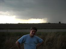
While I was out there, I decided to get a picture of myself out in the snow. I wish I could have taken the picture while there was snow covering the front of my shirt, but that was not to be. Oh, well, there is finally a decent snow in DeKalb! Keep checking in, a forecast will be coming this weekend!


Sunday, November 22, 2009

November 22 Forecast

FORECAST FOR DEKALB AND VICINITY, 11/22/09, 11:00 AM

Today...partly cloudy. High of 55 degrees. Southeast winds at 5-10 MPH.

Tonight...partly cloudy. Low of 39 degrees. East-southeast winds at 5-10 MPH.

Tomorrow...mostly cloudy. High of 54 degrees. East-southeast winds around 5 MPH.

Extended outlook...Tuesday through Saturday...

Tuesday...cloudy with a good chance of showers. Low in the upper 30s. High around 50.

Wednesday...rainy with the possibility of snow later in the evening. Low in the upper 30s. High in the middle 40s.

Thursday (Thanksgiving)...chance of snow showers. Low in the lower 30s. High around 40.

Friday...partly cloudy. Low around 30. High in the lower 40s.

Saturday...partly cloudy. Low in the lower 30s. High in the middle 40s.

*********************************************
CLIMATE DATA: Yesterday's high, 52 degrees; last night's low, 32 degrees. The average high/low temperature is 41/24. We had no rain at the DeKalb campus over the last 24 hours as of 7 AM this morning.

We have had 0.14" inches of rain this month. On average, we should see 2.82" of liquid precipitation by November 30. We have had 42.48" of rain as of this point this year. On average we should have seen 35.22" of annual liquid precipitation by November 30.
*********************************************
SEVERE/HAZARDOUS WEATHER OUTLOOK: No severe weather is expected through Saturday.
*********************************************
PRECIPITATION: Tuesday and Wednesday: .5"-.75", and 60% coverage.
*********************************************
FORECAST DISCUSSION: Not a bad start to the week, with temperatures just above average for this time of the year on Monday. Then Tuesday brings in our weather maker. There is a trough of low pressure in the jet stream, causing a cold front to push into the area, and the system is moving slow. Tuesday through Thursday we will have a chance of precipitation with the chance of seeing snow. As of now, temperatures seem a bit too warm to expect any accumulation.

This morning's surface map shows a cold front just west of Iowa, trailing back through Nebraska, Kansas, Oklahoma, and Texas. There is a low sitting in central Colorado, but mostly high pressure throughout the Rockies. There is also a decaying system off the coast of Washington, with a cold front crossing through western Oregon.

Our forecast concern is the cold front west of Iowa.

Since the front is nearby, we will go back to mostly cloudy skies Monday. Tuesday is when the system hits. Tuesday we can expect to see rain showers thoughout most of the region. This system is still here Wednesday, and it should begin to fall apart. Because of that we should see lighter rain on Wednesday. As the evening progresses on Wednesday, we have a chance of seeing snow. The system should have fallen apart by Thursday, so we should be seeing some left over precipitation. It is looking like we will be seeing some snow still falling on Thanksgiving, but at this time temperatures appear too warm for accumulation. Friday and Saturday the system is out of our area, and we will go back to partly cloudy skies.

So for those who will be staying home for Thanksgiving, this system gives you a reason to stay inside and enjoy the holiday. For those who will be out and about driving, stay safe on the roads. Finally, for those snow lovers out there, keep an eye open Wednesday night and through Thursday, because you might see some.


********************************************
Chuck Richie II
Northern Illinois University undergraduate meteorology student
e-mail: crichie2@gmail.com

Sunday, November 15, 2009

Forecast, As Promised

Alright, here it is! Just finished it about 20 minutes ago. Enjoy!

FORECAST FOR DEKALB AND VICINITY, 11/15/09, 11:00 AM

Today...cloudy. High of 50 degrees. North-northeast winds at 10-15 MPH.

Tonight...cloudy with a chance of rain. Low of 37 degrees. East-northeast winds at 10-15 MPH.

Tomorrow...cloudy with a good chance of rain. High of 49 degrees. East-northeast winds at 10-15 MPH, with possible gusts up to 20 MPH.

Extended outlook...Tuesday through Saturday...

Tuesday...cloudy with another good chance of rain. Low in the upper 30s. High around 50.

Wednesday...a good chance of showers. Low around 40. High in the middle to upper 40s.

Thursday...chance of showers. Low in the upper 30s. High in the middle to upper 40s.

Friday...chance of showers. Low in the upper 30s. High in the upper 40s.

Saturday...partly cloudy. Low in the middle 30s. High in the lower 50s.

*********************************************
CLIMATE DATA: Yesterday's high, 61 degrees; last night's low, 37 degrees. The average high/low temperature is 46/30. We had a trace of rain at the DeKalb campus over the last 24 hours as of 7 AM this morning.

We have had 0.01" inches of rain this month. On average, we should see 2.82" of liquid precipitation by November 30. We have had 42.35" of rain as of this point this year. On average we should have seen 35.22" of annual liquid precipitation by November 30.
*********************************************
SEVERE/HAZARDOUS WEATHER OUTLOOK: No severe weather is expected through Saturday.
*********************************************
PRECIPITATION:
Tonight: .01"-.10"
Tomorrow: .01"-.10"
Tuesday: .10"-.25" with local amounts up to .50"
Wednesday-Friday: .10"-.30"
*********************************************
FORECAST DISCUSSION: This forecast could be summed up in just a few words: wet and cool. Right now it appears that the systems are slow movers, so they will take a little bit longer to leave our area. This is going to keep the weather gray and nasty for the next week, with showers sticking around throughout the week. The rain should not be heavy for the most part, but there could be small pockets of heavier rainfall in these systems.

This morning's surface map shows a low in Ontario, just north of Lake Superior. This has a cold front extending back through Indiana all the way into Texas. There is another low in southern Illinois associated with this front. We also have a low sitting back in southern Colorado. There is also a system sitting off the coast of Oregon, which looks unlikely to reach us.

Our forecast concern starts with the southern Illinois low, and then switches to the Colorado low.

For today, we should be okay with the low in southern Illinois, it will just keep things cloudy. Tonight the low should start to kick up some showers, and then our rain event begins. This system should just kick up a few showers, with nothing too bad.

As the southern Illinois low kicks up some precipitation, the Colorado low begins to move eastward. This system ends up with unfortunate timing for us. The southern Illinois low should move out of the area by Monday night, which is the same time the Colorado low moves in. This low is a bit stronger than the southern Illinois low, so we should see some heavier rain. We could see local amounts up to .50".

This system sticks around until Thursday afternoon, and we may get a few leftover showers Friday. Friday into Saturday, the rain clears up for a bit. It should be partly cloudy those two days, and we may even get back up into the 50s on Saturday. This may only be a slight relief, because it looks like another system will kick in early next week.

This next week is just looking nasty. On the positive side, our temperatures should be around average for this time of year. Unfortunately, it will just be rainy, so probably a good idea to keep an umbrella handy this week.

********************************************
Chuck Richie II
Northern Illinois University undergraduate meteorology student
e-mail: crichie2@gmail.com

Here are the map links I generally add:
250 mb (This one shows a nice deep trough across the US very nicely)
500 mb
Surface

Now back to a nice thing called homework! With some luck, I should be posting again soon!

Saturday, November 14, 2009

Forecast Coming Soon

Sorry there hasn't been a post in ages. School keeps me busy, and even though I have been forecasting, I haven't posted them to the blog, since I have to re-format the forecast for the blog. Anyhow, I will be forecasting tomorrow, so look for one to post sometime tomorrow. With any luck, I should be able to describe some of my recent weather related activity soon too! Anyhow, I've got to get back to a big research project for my Applications of Climatology class right now, but I just wanted to throw out the update that a forecast will be coming soon.

Monday, September 28, 2009

Quickly "Breeze"ing Through Today

It's been a windy one in DeKalb today (September 28, 2009). According to the National Weather Service in Romeoville, IL (the Chicago office), our peak wind gust was 43 mph at 2:45 pm. Some people have wondered why today was so windy. We had a tight pressure gradient behind the cold front that passed through last night. The tight gradient lead to fast wind speeds, keeping our winds sustained at 25-30 mph most of the afternoon. Here is what the map looked like from this afternoon. Source was the Hydrometeorological Prediction Center.


So that is the story on our "breezy" day. Winds should be calmer tomorrow as the gradient will be relaxed over the DeKalb area. And with the high pressure moving in, we should see a few days of nicer weather.


Wednesday, September 23, 2009

September 23 Forecast

Sorry it's been a while. Thanks for the patience. Here is your forecast:


FORECAST FOR DEKALB AND VICINITY, 9/23/09, 2:30 PM

Rest of Today...mostly cloudy. High of 72 degrees. 5-10 mph breeze out of the north, northeast.

Tonight...remaining mostly cloudy, with possible fog. Low of 59 degrees. Winds persist at 5-10 mph out of the north.

Tomorrow...mostly cloudy, with a possibility of showers. High of 70 degrees. Winds pick up to 10 mph out of the northeast.

Extended Outlook...Friday through Tuesday...

Friday...mostly cloudy, with a possibility of rain. Lows around 50. Highs in the low 70's.

Saturday...mostly cloudy. Good chance for rain, with possible thundestorms. Lows in the lower 50's. Highs in the upper 60's.

Sunday...partly cloudy, with a slight chance of showers. Low in the lower 50's. Highs around 70.

Monday...partly cloudy, with showers still possible. Lows right around 50. Highs in the upper 60's.

Tuesday...partly cloudy. Lows in the upper 40's. Highs in the upper 60's.

*********************************************
CLIMATE DATA: Yesterday's High 76 degrees; last night's low 60 degrees. The average high/low temperature is 68/44. We had .44" of rain at the DeKalb campus over the last 24 hours as of 7 AM this morning.

We have had 1.07" inches of rain this month. On average, we should see 3.47" of liquid precipitation by September 30. We have had 32.41" of rain as of this point this year. On average we should have seen 29.80" of liquid precipitation by September 30.
*********************************************
SEVERE/HAZARDOUS WEATHER OUTLOOK: Fog is the primary severe weather concern at this time. Areas of fog will appear overnight, so take caution if you are out at night.
*********************************************
PRECIPITATION: Friday looks like the day where we will see rain. It looks like the area will see about .25"-.50" of rain.
*********************************************
FORECAST DISCUSSION: Currently, there is a big trough of low pressure in the jet stream. It is sitting right over Kansas and Nebraska, and it will be our main forecast issue through this week.

This morning's surface map shows the cold front that passed over our area last night. The low is over Lake Huron, with the front trailing across Ohio, Indiana, the southern tip of Illinois, and back into mid Arkansas, where another low is sitting. This system continues to trail into the Gulf of Mexico.

The second system is the low placed over Hudson Bay, with a cold front moving south across Ontario. This may find its way down to us later this week. There is also a low centered over Kansas, which will impact us later this week. Finally, there are a few high pressures marked over the Rocky Mountains.

Our first concern is the low over Hudson Bay. This system is making a southerly push, and should be across the northern Illinois region by Thursday morning. This system may clip the edge of the area, and may produce some rain showers Thursday.

Friday our main concern is the low pressure system over Kansas. Friday morning looks like the time when this system will hit. There will still be good cloud coverage, so we will not have enough instability for organized thunderstorms. However, our current dewpoints are fairly high, and with the system hitting, we will have enough moisture and lift to expect rain showers. It looks like this will bring anywhere between .25" and .50" of rain to the area.

This system will be staying around the area Saturday and Sunday, so we can expect to see additional rainfall this weekend. However, this should not be too intense of a rain event. Weekend totals, including Friday, look to be around 1". There is a small chance of thunderstorms this weekend, but nothing severe is expected.

The system should be out of the area by Monday, and we may see increased winds behind the system. On the other hand, a high pressure system will be moving towards our area, so we should be seeing some sunshine Monday and Tuesday.

So for the next few days, be prepared for cloudy skies, possible showers, and highs around the low 70's and upper 60's. Get ready to get some rain this weekend, but remember, sunnier skies are coming early next week.

*********************************************
Chuck Richie II
Northern Illinois University meteorology student
e-mail: crichie2@gmail.com


I added some additional links for some fun! Now you have a moving surface forecast map, and forecast rain totals! Hope you enjoyed it!

Friday, September 4, 2009

Labor Day Weekend Forecast

Alright here goes nothing! I haven't heard any critique on it yet, so it may still get improvements:

FORECAST FOR DEKALB AND VICINITY, 9/4/09, 2:30 PM

Rest of today...Clear skies. High of 79. Calm winds.

Tonight...Still staying clear skies. Low of 53. Winds remain clam.

Tomorrow...Skies remain clear. High of 78. Winds pick up to 5-10 MPH out of the east.

Extended Outlook...Sunday through Thursday...

Sunday...Skies shift to partly cloudy. Lows in the lower 50s. High in the upper 70s

Monday(Labor Day)...Partly cloudy conditions remain. Low in the mid to upper 50s. High in the lower 80s.

Tuesday...Partly cloudy, possibly showers. Low in the upper 50s. High in the upper 70s.

Wednesday...Partly cloudy with a possibility of showers. Low in the upper 50s. High around 80.

Thursday...Chance of showers and thunderstorms. Low in the lower 60s. High in the mid 70s.

*********************************************
CLIMATE DATA: Yesterday's high 74 degrees; last night's low 54 degrees. The average high/low temperature is 80/56. We had no rain at the DeKalb campus over the last 24 hours as of 7 AM this morning.

We have had 0 inches of rain this month. On average, we should see 3.47" of liquid precipitation by September 30. We have had 31.34" of rain as of this point this year. On average, we should have seen 29.80" of liquid precipitation by September 30.
********************************************
SEVERE/HAZARDOUS WEATHER OUTLOOK:Except for patchy fog Friday night into Saturday morning, the weekend should not see severe weather.
********************************************
PRECIPITATION: No precipitation this weekend.
********************************************
FORECAST DISCUSSION: The pattern aloft seems to stay steady, with a nice, steady ridge. This should continue to give us our high pressure, keeping nice weather throughout the weekend. A relatively deep trough is currently sitting off of the West Coast, which should break through into the forecast area later next week.

On the surface map, there is a cold front associated with the trough on the West Coast. The cold front is currently west of Oregon and Washington. That should initiate some rain for them.

There is also a low in northern Alberta, Canada. This has a cold front that extends into Wyoming, and a stationary front that extends over Minnesota and over Lakes Superior and Huron.

Our forecast issues are events later in the week.

Today, the weekend, and Monday...The ridge aloft will keep the higher pressure in our area leading to fair weather throughout the weekend. As the trough off the West Coast begins to travel eastward, it should intensify our ridge. This will lead to a greater southerly flow, which should increase temperatures and dewpoints in our area.

Tuesday...Models indicate that a system should be pushing through our area. Although the precipitation shows up to the south of here, I went ahead and put in a possibility of showers. I think we should stay dry, but I can't rule out the possibility of light showers.

Wednesday and Thursday... These days look like we are going to get hit with some rain. It looks as if a second system will move on top of our area and rain on us. Wednesday may see remnants of Tuesday's system, and it may see the new system later in the day. Thursday seems to be the day we get hit with the full force of the second system.

So the weekend looks great. Go out and barbeque, or whatever you do for Labor Day. The next few days afterward, you might want to have an umbrella handy, just in case.

*******************************************
Chuck Richie II
Northern Illinois University undergraduate meteorology student
e-mail: crichie@niu.edu

Some changes may come specifically for blog posts, but we'll see how that plays out. I went ahead and threw some links in for you. Enjoy!

Thursday, September 3, 2009

Coming Soon

Wow. Sorry for the very lengthy absense of a post.

So, coming soon:
I was fortunate enough to be selected an internship with NIU Staff Meteorologist, Gilbert Sebenste, this semester. I will have to write forecast discussions for DeKalb and surrounding areas for this internship. I will be adding the discussions I write to the blog, so there will be a slight change in the discussion format. I'll try to add some maps in for the blog posts, like I have been, but it will be a change of pace. I hope you will enjoy the discussions. And as always, if something really cool happens, and I get pictures of it, they will be posted. Thanks for reading, and thanks for your patience.

Thursday, June 11, 2009

Always When You Don't Have A Camera Handy...

Gah! Caught without my camera on a beautiful storm! Last night (6/10), one of my buddies picks me up to head to Wood River, IL, so that we can play a trivia game at a local Applebee's. This is about 9:00 pm, so our light sources are pretty much city lights and lightning. We go pick up another friend and begin our drive to the restaurant. Right over the river, near the Melvin Price Lock and Dam in Alton, IL, I see a distinctive lowering in the cloud base. I was suspicious, so I call my dad to give a heads up that this storm may try to pop a wall cloud. I later hear that a wall cloud was reported at our location by a trained spotter, just about the same time I called my dad. We were pretty late for trivia (20 minutes late, as time is now 9:20pm), so we decide to take a detour. We go in a loop around Wood River so we can watch the storm. The lightning was just amazing. We had what I call "spider-effect" lightning, which is cloud-to-cloud lightning that spreads out. We also saw a lot of cloud-to-ground. It was great!

Finally, we start heading back towards Wood River, and this time we had no doubt of this lowering. A textbook wall cloud was hanging over the refinery. I know it would have been difficult to get a picture even if I had my camera, but this was a picture perfect wall cloud. I couldn't tell if it was rotating, due to the lack of light. This was right around 9:30 pm. This wall cloud dissapated after after 5-10 minutes. By time we got to the restaurant, it was gone.

The irony to this whole night: I was about to grab my camera as I left, just in case we ran across some interesting storms!

Monday, May 18, 2009

5/19/09 Wx Discussion

Well this is going to be dissapointing after all the "good" weather we have been having. (By good weather, I mean thunderstorms). Anyhow, it looks like the pattern has settled down for a while(....sigh).


We are currently under a ridge (500 mb) on both locations, which should lead to relatively sunny weather for some time. The current run of the GFS model, which can forecast out about 10 days, shows little action at 500 mb or the surface. There is really no action until we are about 6 days out on the model (in a realm known as "crystal ball realm." The models generally have trouble with accuracy that far out.). The precipitation that does pop up on the model appear to be a linear thunderstorm. However, models, such as the GFS, generally have trouble with thunderstorm (and you probably don't want the technical reasons).


So, overall, it looks like nice weather in both Alton and DeKalb. I guess we have to deliver the message of nice weather too.


Alton:

Tuesday: Sunny. Hi 77, Low 54.

Wednesday: Sunny. Hi 80, Low 58.


DeKalb:

Tuesday: Sunny. Hi 74, Low 53

Wednesday: Sunny. Hi 78, Low 55

Saturday, May 9, 2009

An Unintended Chase

May 7, 2009. What a great day! I was moving out of college and going home for the summer. During the drive south, we had to go through a SPC slight risk. We ended up leaving at a great time, and we saw some AMAZING weather! I was driving, so my dad took the following pictures.


This wall cloud was between Lincoln and Springfield, Illinois. We were driving 55 south looking west. This picture also has a very nice rain foot to the side of the wall cloud. A wall cloud is indicative of a strong updraft in the storm. If it is rotating, it is a prime place for tornado development. It doesn't garuntee a tornado. The rain foot shows the precipitation falling and spreading the rain cooled air on impact. It resembles a foot.


As we got south of Springfield, we noticed another wall cloud. We pulled off the side of the road to watch this one for a little while. This one actually was rotating. It was really cool to watch the clouds form right off the tip of the rain foot. Neither of these wall clouds produced a tornado, but they were cool to watch!


This is another view of the Springfield wall cloud. You can see the rain foot wrapping around the backside of the wall cloud in this picture.


Here is a video of the rotating wall cloud. It is a bit difficult to see on the video, but it was rotating very nicely. (We also had a lot more time to watch it, so it was easier to see it rotate.)


Here are some pictures of this impressive storm we were under. These were taken outside of Litchfield, IL looking north:


Later that night, a storm rolled through Alton, IL. There was actually a wind damage report, as one of the older buildings had a roof blown off. (SPC Reports). I was able to see some hail from my house and catch some lightning shots.


I like how you can see the hail falling in this picture. I wasn't even trying to get this picture of hail falling, but I caught it and am quite happy with it.


Just an idea of how much hail fell. Mostly pea-sized, but we had a few that were around 3/8 inch.


I tried to get some lightning, but it is hard to photograph. I did end up with some interesting lightning shots:


Well, that's all for this time. Hope you enjoyed it as much as I did!

Wednesday, April 22, 2009

April Snow Update

After all the panic, no snow fell in DeKalb. Tuesday saw a rather nasty day of mist to light rain conditions. According to the National Weather Service out of Romeoville, Illinois (the Chicago office), there was some pea-sized hail in the region.

Throughout the day Tuesday, I mostly walked in light rain. On my way back from my morning class, I did see some snow-like precipitation, but very little. I saw a few small flakes (probably about 5-10 in total), and a little frozen precip, but for the most part it was rain.

Conditions are currently sunny and warming. Currently it is 59 degrees, and temperatures in the low 80's could be seen Friday and Saturday. I am getting this straight from the National Weather Service today, as I am a little time crunched. However, we will be entering a 500 mb ridge, which should keep our weather nice. I'd better wrap this up, because I still have a lot to do before the end of the week. I'll get another post up as soon as I can.

Monday, April 20, 2009

S-S-S-Snow!!!! In Late April?!

This seems to be a fairly popular topic in DeKalb lately. There is a fair chance of seeing some late April snow. This has left some people panicking, however, it seems to really be nothing.

As always, let's get ready to do some map analysis! Current 500 mb maps show an upper level low parked on top of DeKalb. This is sitting in a pretty nice trough. A look at the surface map shows a low pressure located in northern Michigan. Now it is time to look at more features. At 850 mb, We can see a freezing line in central Illinois. This level is around 1250-1500 meters above the surface. If we were to look at another upper air tool, called a sounding, we can look at temperatures in a vertical profile. I am going to use the Davenport, Iowa sounding from 0000Z, which is the evening sounding. I have added a thick blue horizontal line to indicate the freezing line. The vertical red line indicates temperature with height, and the vertical green line indicates dew point with height. Where they are close, the atmosphere is moist. This is a pretty moist profile, extending up to about 600 mb. So, most of the moisture is above the freezing line in this profile, indicating that if precipitation falls, it will fall frozen. Below the freezing line, it will more than likely melt.

So, what is going to cause the snow? It appears that the low in Michigan will be the problem. Motion around a low is counterclockwise. So, the precipitation forming around a mid-latitude cyclone will follow this motion. Areas north of the warm front are cooler, in this case cool enough for snow. The snow will follow the motion around the low, driving the snow and cool temperatures towards DeKalb.

As for accumulation, I don't think we will see any. Forecast soundings indicate that surface temperatures will not reach freezing. Both the GFS and NAM models are in fair agreeement that the nighttime lows will be around 36 degrees into Tuesday morning. Tuesday highs should be around 46, with Tuesday night/Wednesday morning lows being around 36 again. There is about a 70-80% chance of precipitation. We will also be having northerly , turning into westerly, surface winds around 15-20 miles per hour Tuesday, which will keep the air feeling cooler. With highs expected in the 40's, I would expect to see some rain as well.

To sum it all up, yes we may see snow in DeKalb. However, it will proabably have rain mixing in as the day progresses, and we probably won't have an accumulation. If we do end up with accumulation, it will be minimal, and probably won't last long.

Sunday, April 19, 2009

Update

I know I have not posted in a while (almost a month). School has really kept me busy these past couple of weeks, and the next two to three weeks look pretty full, especially with the semester ending. It may be a little while more before I can post a forecast. I really want to do another forecast discussion, but time is not on my side right now. With any luck, a time slot may open for a forecast discussion. Thanks for the patience.

Sunday, March 29, 2009

Storm Video/Pictures

Wow. It has been a while since my last post. Since then, there has been some pretty crazy weather. Here is some video and pictures to enjoy.


The first is from March 9. This was the day before the "Man vs. Machine" contest. I was on spring break, and what a way to start it with some severe weather. There was a tornadic storm roughly twenty miles northwest of Alton, IL. Here are the SPC Storm Reports from that day. From my house, I was standing in the inflow. It was relatively calm, and then strong sustained winds blew in the direction of the storm. I have a short video clip of the inflow.


Next, I have some pictures from DeKalb, IL. This is from the rather wicked snowstorm on March 28. These pictures were taken March 29 at around 2:15 pm. Unfortunately, the snow had started to melt, so I could not capture the full effect of the storm on camera. Earlier in the morning, the snow was much higher than what I caught on camera later in the day. I regret not getting some pictures of the higher snow, but I have some pictures nonetheless.


Well, that is all for this post. Just posting these few things for now. Hopefully another forecast will be coming up soon, but school has to take priority.

Thursday, March 12, 2009

Forecast Verification

Just as important as the forecast is the verification. In the man vs. machine contest, the only way to guage the results is to look at what actually happened.

Alton:
Tuesday Night:
Actual Low: 29

Forecast:
Man: 29
GFS: N/A
NAM: 28

Wednesday:
Actual High: 36

Forecast:
Man: 40
GFS: 46
NAM: 41

Actual Precip Total (for the forecast period): 0.16"

Forecast:
Man: less than 0.25"
GFS: less than 0.1"
NAM: 1.0" or greater


All three (man, GFS, and NAM) were correct on sky cover, as Wednesday was clear.

So, the results lay in the eye of the beholder. It really depends on what each individual believes. I believe I beat the computers. My low was spot on, I was off on my high, and a little high on precip totals. However, I believe my results were closer to the actual readings than the models.

My mistakes are explainable. For my high, I chose a target too far south, but at the time, it was the only area behind the front in sunlight. As for rain, I believed that there would have been heavier rain associated with the band of showers.

Well, that raps up this contest of man vs. machine. Hope you enjoyed it as much as I did!

Tuesday, March 10, 2009

A Happy Compromise

As stated, meteorologists should use models for guidance. Now, I will forecast DeKalb using model guidance. The pattern doesn't really change between DeKalb and Alton, except for the low pressure center and warm front between them. However, the cold front will pass over DeKalb as well. I am going to cut to the chase since I have already looked at the scenario, and quite frankly looked at this computer screen long enough.

Tonight's Low: 19
Tomorrow's High: 29
Should be clear skies.
60% chance of rain tonight, 0 % chance of precip tomorrow.

Sorry to be so breif on the forecast today.

Man vs. Machine

Finally, the promised man vs. machine contest! For even more fun, the Storm Prediction Center has issued a slight outlook. So, for this forecast, the focus point will only be on Alton, IL. Why? Because I am here and can make observations here, physically. For the DeKalb viewers, I will put a forecast for DeKalb following. Remember, the situation is that I will forecast only based on observations, radar, and satellite. Unfortunately, I am not having luck loading my hand analyzed maps to this post. So, to give an idea I will use the same old links.

So the situation at 500 mb is a trough over the western and central United States, with ridging starting in the east. Wind speeds at 500 mb around the region range from about 70-75 knots from the southwest. The surface map has shown chnge in roughly 4 hours. My 1500 Z (10 am) surface placed the low in north-central Missouri, with a warm front just north of St. Louis. The cold front trailed back west of Springfield, MO. The following surface map is form the Hydrometeorological Prediction Center. Remember these links will change as time progresses.

Based on the surface map, I would predict that the low will track towards the north, northeast, following up the cold side of the warm front. This will swing the cold front around closing in on St. Louis and Alton. Currently in Alton, the temp is 78, with a dew point of about 57. Conditions are cloudy, preventing surface heating, which in turn, lowers the amount of instability. However, radar indicates storms north of the area. We will have moisture and lift (thanks to the cold front). The Lincoln, IL sounding from 1800Z (1 pm), was the closest recent sounding. There was a small amount of CAPE (Convective Available Potential Energy), a measurement of instability, in this sounding. It appears even though small, there was enough instability for convection to begin with the lift of the cold front.

It does appear that storms will occur in this area in the late afternoon into the evening as the cold front passes over. The current storm system is pretty much linear (due to the front), so the greatest threat is damaging wind, but given the set up, I do not believe we will see any of this in Alton.

As for temperatures, I will examine temps and dew points behind the front. Dews that should come in the area should be in the lower thirties/upper twenties. Looking at clearer areas behind the cold front, temperatures are around 40 degrees.

Putting it all together now;
Alton should see some storms push through this evening. They will probably go quick as the system begins to move out of the area. I would expect clearer skies tomorrow. As for tonights lows, probably around 29 degrees (based on dew point). With the clearer skies, one would expect to see similar temperatures in clear regions behind this front. I believe the high will be around 40 tomorrow. With this system moving through pretty quick, and with lighter rains in this system, I don't think we will see more that .25 inches.


Alright there was the "man" forecast, now for the "machine forecast":


GFS(Global Forecast System):
Low: N/A
Hi: 46
Chance of Precip (tonight): 58%
Chance of Precip (tomorrow): 0%
Tomorrow: Clear
Precip Total <.10"


NAM(North American Model):
Low: 28
Hi: 41
Chance of Precip (tonight): 87-67% (Decreasing over time)
Chance of Precip (tomorrow): 1-5%
Tomorrow: Clear
Precip Total: 1" or greater

Monday, March 2, 2009

Quick Update

Sorry I have not put up a post in some time. It seems that I will be rather bogged down with school work until the end of this week (midterm time!). More than likely, I won't be able to update a forecast until Spring Break, which starts Saturday. With any luck, a forecast should be up sometime around next Monday.

Wednesday, February 25, 2009

Whoops

Okay, I admit to screwing up the DeKalb forecast. I put overcast, and it was clear, all day. I can only blame myself for trusting model data, instead of myself. Initially, MOS (model output statistics) guidance indicated overcast conditions all day in DeKalb. I was not fully convinced, but just to make sure I did not miss anything, I checked the area forecast discussions from 3 National Weather Service offices: Chicago, St. Louis, and Davenport. All three indicated cloudiness, but all three had different reasons. One suggested clouds were moving in from western Illinois, which after looking at infrared satellite, showed no clouds in or around Illinois. Another suggested a 500 mb shortwave trough, which after looking at a 500 mb map (and practically squinting at it), I could barely find evidence of a shortwave. The third office suggested moisture flowing in with the low level jet, which is what I went with after seeing a nice low level jet off the Gulf of Mexico at that time. My initial thoughts made me question whether the discussions were trying to explain what was happening or if they were trying to verify what the model suggested.

Needless to say, instead of forecasting with my instinct, which told me little to no clouds in DeKalb, I went with the "meteorological cancer" (which is going with what the model suggests). I regret my decision, especially since I had read a few hours before forecasting that the models were not handling the weather very well. So, I admit my mistake. To avoid this next time, I am going to "challenge" the models to a forecast contest. Next forecast, I will NOT use any models, only data (which includes observed conditions, satellite, radar, and hand analysis maps) and my meteorological knowledge and instinct. After this, I will post a forecast using model guidance, without my input (meaning I will just put down what the models suggest, none of my own thoughts). My goal is to show that meteorologists need to use models only for guidance, and not base a forecast on them alone. Stayed tuned for the contest of man vs. machine!

Tuesday, February 24, 2009

February 25

The pattern remains pretty zonal at 250 and 500 mb. Surface fronts are developing which could bring precipitation into the forecast areas later Wednesday evening. Forecast surface maps show this system moving across the area (just click on the box to advance the maps at the link). These appear to bring precipitation with them. It appears that a low level jet will bring moisture across the forecast areas, which looks to be a cause of cloudiness.

It appears that Wednesday will be fairly cloudy with a small chance of rain.

DeKalb: Overcast, Hi 42. Low 29. Chance of rain 30%. Winds 12-17 mph.

Alton: Mostly Cloudy, Hi 61. Low 44. Chance of rain 10%. Winds 5-10 mph. However, with the front, there is a chance of storms in the evening.

Sunday, February 22, 2009

Feb. 23 Forecast

The current weather pattern seems to be ridge/trough. Upper air maps as of 6 pm show this pattern (250 mb , 500 mb)(**Note, links will change with time. I previously forgot to mention this.**). The ridge will move into both areas of interest (DeKalb and Alton), along with surface high pressure. This will bring clear skies and mostly calm winds into both forecast areas.

Basically, this just becomes a temperature forecast.

DeKalb: High 24, Low 16. Sunny. Winds should be at most 10 mph

Alton: High 38, Low 24. Sunny. Winds should range between 5-10 mph.

Hopefully some "weather" will happen when I have time to go in depth. This weekend woulb have been nice, but I was unfortunately busy. Maybe next time.

Video From 2/21/09

Here is the promised video from Feb. 21. The constant "rushing" noise and "cracking" pops are both wind. Just an idea of what was going on.

Saturday, February 21, 2009

2/21/09

Sorry there were no forecasts the last couple of days, school has kept me busy.

Currently it is very windy and is snowing in DeKalb. Currently the National Weather Service has DeKalb in a winter weather advisory.
Here is what they have to say:
A WINTER WEATHER ADVISORY REMAINS IN EFFECT UNTIL 6 PM CST
/7 PM EST/ THIS AFTERNOON.

THERE HAVE BEEN 2 TO 4 INCHES OF SNOW THIS MORNING. WE
EXPECT ANOTHER 1 TO 2 INCHES OF SNOW THIS LATE MORNING
AND AFTERNOON. THE WIND WILL BECOME NORTHWEST WITH
SPEEDS OF 15 TO 25 MPH AND GUSTS OF UP TO 34 MPH. THIS
WIND MAY PRODUCE BLOWING AND DRIFTING SNOW THIS LATE
MORNING AND EARLY AFTERNOON.


A WINTER WEATHER ADVISORY FOR SNOW MEANS THAT
ACCUMULATING SNOW WILL CAUSE PRIMARILY TRAVEL
DIFFICULTIES. BE PREPARED FOR SNOW COVERED ROADS
AND LIMITED VISIBILITIES...AND USE CAUTION WHILE
DRIVING.

Hopefully, I will be able to do a forecast discussion soon,
but I am a little pressed on time at this moment. Later
I will post a video clip from 1:30 pm, showing conditions
in DeKalb at time of this post. It is a little hard to see,
since there is a lot of little snow flakes being blown in
high winds.

Wednesday, February 18, 2009

Correction

Naturally, after you post "there were no tornadoes", they decide to drop. As of now 3 tornado reports. Pure irony. Here are the storm reports.

Stormy South

Earlier today(Feb. 18), the Storm Prediction Center had a moderate outlook in the south. There was about a 10% probability for tornadoes, but no tornadoes were reported. There were plenty of tornado warnings, but all were "Doppler Radar indicated." From what I have read, these storms produced funnel clouds, but just could not make the stretch to tornado. There was a fair amount of hail reports with these storms. The nice thing is it gave us weather fanatics a little convection in what seems to be an endless winter. The Storm Prediction Center reports for this event can be found here.

Snowy DeKalb

I just missed the slightly heavy snow with my camera, but was able to get this clip of snow around 4:30pm.

2/19/09 Forecast

The pattern appears to be similar. Mostly zonal flow across the country at 250mb. However, that includes "mostly." There is a ridge/trough pattern shown at 250 and 500 mb. These links provide a look at the maps presently. The nice thing about this is it should break the clouds in DeKalb. It will also provide clear skies in Alton (but this is also due to the frontal passage). There is also some high pressure in the Dakotas and Canada that will move in with this. This will bring the sun! The surface chart shows the basic set up (from what data I had) as of 4:00 pm Feb. 18, 2009.
The trick was looking at MOS guidance for highs and lows. DeKalb is a mess. We should have clear skies under high pressure, and IR satellite imagery shows clouds moving out at this time. MOS shows cloudy. Therefore, I am not confident with its results for DeKalb. It is slightly better for Alton, as in it shows clouds moving out, but not quick enough.

It all (with a lot more not included in this discussion) comes down to this for Thursday:

DeKalb: Sunny. Windy (due to the pressure gradient), with winds around 20mph. High should be about 21 degrees. The low will be about 12 degrees.

Alton: Sunny. Winds should be about 15 mph (the pressure gradient is slightly weaker). High should be 32, with a low of 20.

Tuesday, February 17, 2009

Precip On The Way

OK, so the first run is a late-night forecast. I am not intending to go too in depth this time, more or less just getting a test run in. I am not sure what maps and such can be displayed, so, I apologize in advance that this discussion will have no maps.

The situation appears to be fairly zonal flow at 500 mb, at this time. 500 mb maps are showing undulations within this pattern. 250 mb maps are almost zonal, except for a small ridging over the Midwest. Skipping around to 850 mb, there is plenty of warm air advection to be found across both Alton and DeKalb. There is also a fair amount of moisture at this level. Maps looked at were from http://www.rap.ucar.edu/weather/

The trouble appears at the surface. Currently an extratropical cyclone is sitting in Eastern Kansas. The Hydrometeorological Prediction Center is forecasting the low to track between the two sites, meaning north of Alton and south of DeKalb. The low is projected to cross over the Northern Illinois region. This will probably give DeKalb a mix of precipitation. Bufkit data from nearby Rockford indicates a deep level of moisture, but the temperature "dances" around the zero degree line.

After looking at MOS guidance, this quick forecast comes down to this:

DeKalb is going to see a high around 38 and a low of 14. It looks to be cloudy, and as typical of DeKalb, windy. Winds will probably be about 10-12 mph, but pick up to about 20-25mph. It is looking like a 70% chance of precipitation, switching from rain, snow, sleet, and some freezing rain. All I have to say is "Yuk!"

Alton will see highs around 47 and lows around 22. There is a 30% chance of rain, which could switch over to snow in the evening. It will also be cloudy in Alton, and should be breezy. Winds will probably pick up from 10-12mph to 18-20mph.