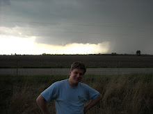
Alright here goes nothing! I haven't heard any critique on it yet, so it may still get improvements:
FORECAST FOR DEKALB AND VICINITY, 9/4/09, 2:30 PM
Rest of today...Clear skies. High of 79. Calm winds.
Tonight...Still staying clear skies. Low of 53. Winds remain clam.
Tomorrow...Skies remain clear. High of 78. Winds pick up to 5-10 MPH out of the east.
Extended Outlook...Sunday through Thursday...
Sunday...Skies shift to partly cloudy. Lows in the lower 50s. High in the upper 70s
Monday(Labor Day)...Partly cloudy conditions remain. Low in the mid to upper 50s. High in the lower 80s.
Tuesday...Partly cloudy, possibly showers. Low in the upper 50s. High in the upper 70s.
Wednesday...Partly cloudy with a possibility of showers. Low in the upper 50s. High around 80.
Thursday...Chance of showers and thunderstorms. Low in the lower 60s. High in the mid 70s.
*********************************************
CLIMATE DATA: Yesterday's high 74 degrees; last night's low 54 degrees. The average high/low temperature is 80/56. We had no rain at the DeKalb campus over the last 24 hours as of 7 AM this morning.
We have had 0 inches of rain this month. On average, we should see 3.47" of liquid precipitation by September 30. We have had 31.34" of rain as of this point this year. On average, we should have seen 29.80" of liquid precipitation by September 30.
********************************************
SEVERE/HAZARDOUS WEATHER OUTLOOK:Except for patchy fog Friday night into Saturday morning, the weekend should not see severe weather.
********************************************
PRECIPITATION: No precipitation this weekend.
********************************************
FORECAST DISCUSSION: The pattern aloft seems to stay steady, with a nice, steady ridge. This should continue to give us our high pressure, keeping nice weather throughout the weekend. A relatively deep trough is currently sitting off of the West Coast, which should break through into the forecast area later next week.
On the surface map, there is a cold front associated with the trough on the West Coast. The cold front is currently west of Oregon and Washington. That should initiate some rain for them.
There is also a low in northern Alberta, Canada. This has a cold front that extends into Wyoming, and a stationary front that extends over Minnesota and over Lakes Superior and Huron.
Our forecast issues are events later in the week.
Today, the weekend, and Monday...The ridge aloft will keep the higher pressure in our area leading to fair weather throughout the weekend. As the trough off the West Coast begins to travel eastward, it should intensify our ridge. This will lead to a greater southerly flow, which should increase temperatures and dewpoints in our area.
Tuesday...Models indicate that a system should be pushing through our area. Although the precipitation shows up to the south of here, I went ahead and put in a possibility of showers. I think we should stay dry, but I can't rule out the possibility of light showers.
Wednesday and Thursday... These days look like we are going to get hit with some rain. It looks as if a second system will move on top of our area and rain on us. Wednesday may see remnants of Tuesday's system, and it may see the new system later in the day. Thursday seems to be the day we get hit with the full force of the second system.
So the weekend looks great. Go out and barbeque, or whatever you do for Labor Day. The next few days afterward, you might want to have an umbrella handy, just in case.
*******************************************
Chuck Richie II
Northern Illinois University undergraduate meteorology student
e-mail: crichie@niu.edu
Some changes may come specifically for blog posts, but we'll see how that plays out. I went ahead and threw some links in for you. Enjoy!
Friday, September 4, 2009
Subscribe to:
Post Comments (Atom)

Thanks, Chuck. It's nice knowing a weather guy.
ReplyDelete